|
[
travelogue |
contact greg ]
RENO, IDAHO,
WASHINGTON

September 18th - October 4th, 2005
Two and a half weeks by car, to visit friends at the Reno Air Races, Elizabeth and Leroy in Northern Idaho, Philip and Elinor in Northeast Washington, and then all the way back home.
Please note: This web page is really large, and will take a long time to fully load. All of the pictures are on this single page, and there are a lot of them. With luck, the pictures will at least load in top-to-bottom order, if you read all the captions, you might not even notice the delay...
I've tried to let the photos tell the story, with long captions to reach those difficult nooks and crannies. I've left the photos mostly untouched, and kept the captions relatively short, in the interests of quicker site creation, and viewing. (Sometimes, it feels like the website takes longer than the trip did.) There are many people, places, and things, that I would like to have mentioned, but didn't, and can only watch as the memories slip off into oblivion. So, please excuse the verbosity where it is encountered, I was only fighting the good fight.
|
|
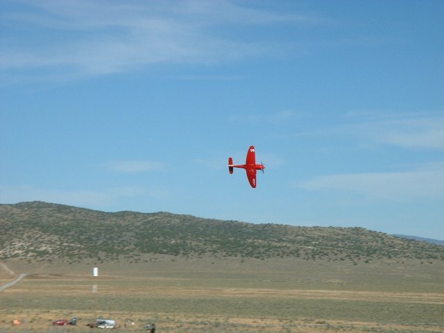
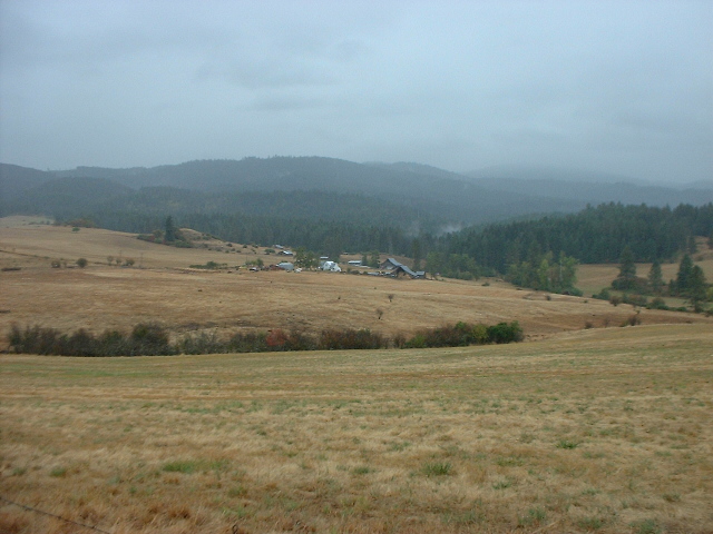
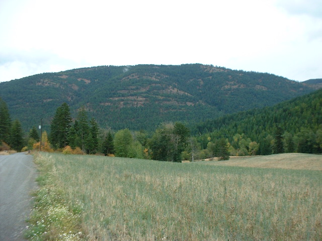
First stop, the Reno Air Races. Every September, the racing aircraft of America and the world, come to Reno's Stead airfield (retired AAF base) for a weekend of racing around pylons (white object in picture) set up in the desert. Many thousands of people come to watch, including the 500 or so folks who camp along the course's north edge.
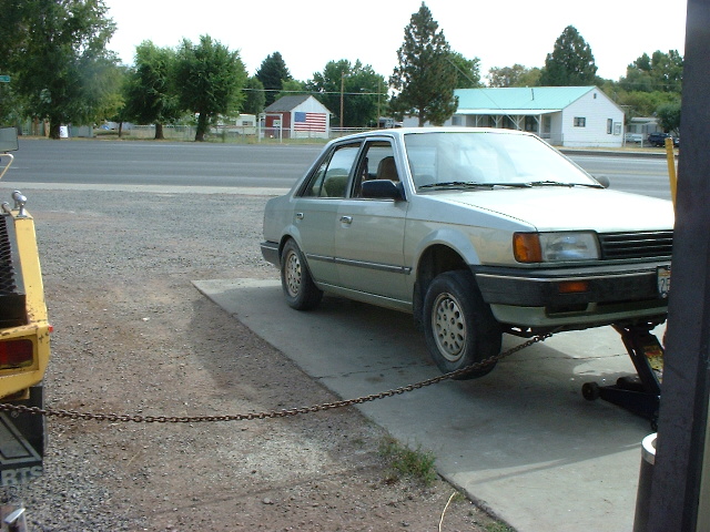
I had left home early Sunday afternoon, late. My most-recent motorcycle engine rebuild project had failed again, so I was forced to change gears and take the car. Bor-ing! The weather (so far...) was much too nice for the car, but, beggars can't be choosers. I was off.
|
|
|
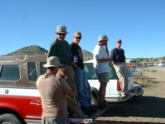
The group with whom I camp, the self-proclaimed Goon Squad, are originally out of Portland, but have since metastasized around the West, extending their reach to Utah, eastern Oregon, Reno, and Arizona, as well as greater Portland. These guys are children of the 70's (and 60's), teenage potsmokers, current motorcycle and gun owners, pilots and skydivers, forest firefighters, and somewhat-left-leaning registered Republicans. Most of the guys are most of the above, and several of the older guys are Vietnam vets. A great crew.
|
|
|
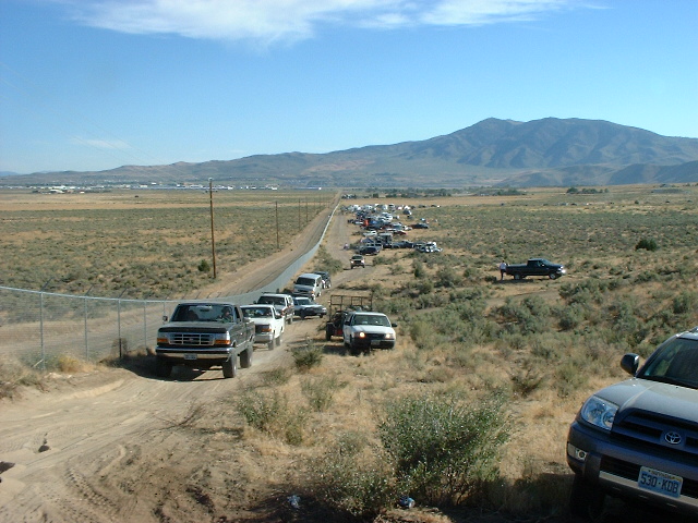
The layout of laying around. The various "camps" (Burning Man lingo, but appropriate) are spread down this road, alongside the race course. In this shot, maybe half the people have already left, and the line of vehicles is heading for home, after a weekend of racing and drinking.
|

|
|
A late-40's/early-50's vintage Lockheed Shooting Star. The racing, like most motorsports racing, is divided into various classes, ranging from biplanes, to a couple of classes of piston-engine monoplanes (dominated by souped-up WWII fighters, particularly the Grumman Bearcat, North American P-51 Mustang, and English Sea Fury), on up to one or two classes of jets. My late arrival this year meant that I only caught a single race, but I guess that's enough. I came for the people, mostly. The jet pictured here isn't racing, it's just one of the many fascinating aircraft buzzing around all weekend. (Have you ever seen a Saab Draken fly? How about a MiG-17, or F-84 ThunderJet? I could go on, but the '50s fighters are at the top of the heap, in my opinion.)
|
|
|
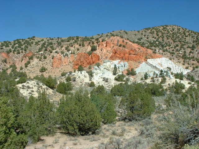
Who says Nevada's deserts are boring? The last of my Air Races friends left at noon (for Salt Lake City), and I left too. Heading north through horse country, I stopped at Red Canyon (another really creative name), then rejoined Hwy395. I don't care much for 395 - you'd think it'd be a great and historic route, along the back of the Sierra Nevada Mountains, but it's really kind of congested. (North of Susanville, it gets cool, and stays cool through eastern Oregon.) So I was looking for a "shortcut", when...
|
|
|
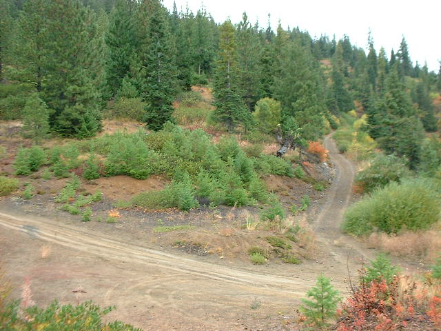
"Is this the shortcut to Oregon?" Well, yes, except for the "short" part. After leaving the Air Races campsite, I was feeling a little blue. Car travel, as compared with bike travel, is comfortable but boring. By bike, I would be "going, to Idaho". By car, I was "going to Idaho". But I didn't want to go to Idaho, I just wanted to go. So I took a little multi-hour shortcut from the cute and decrepit little village of Doyle, on Hwy395 north of Reno, around the back of Honey Lake, past the Sierra Army Munitions Depot, to catch Hwy395 again, but without having to see the signs for the High Desert Correctional Facility near Susanville, or the new prison being built at the (truly ironically named) town of Herlong. Military bases, I love, prisons, I hate.
|

|
|
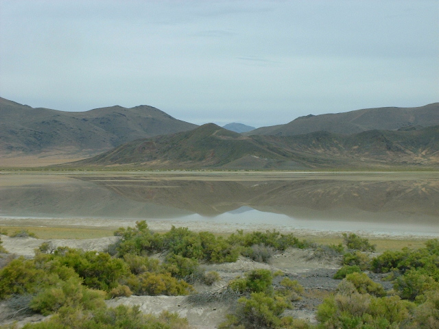
Big dry lakes, like the Black Rock Desert, are fairly rare, and very wonderful. But little ones like this abound, and are still moderately wonderful. Unless they're wet and you get stuck, in which case, they're goddamn wonderful.
|

|
|
This was a house, of sorts. Why did they build all those little two-story "housettes" in desert Northeastern California? This one has what looks like a cistern (water tank) on top. Nearby is a small barn, corral, and rabbit weir.
|
|
|
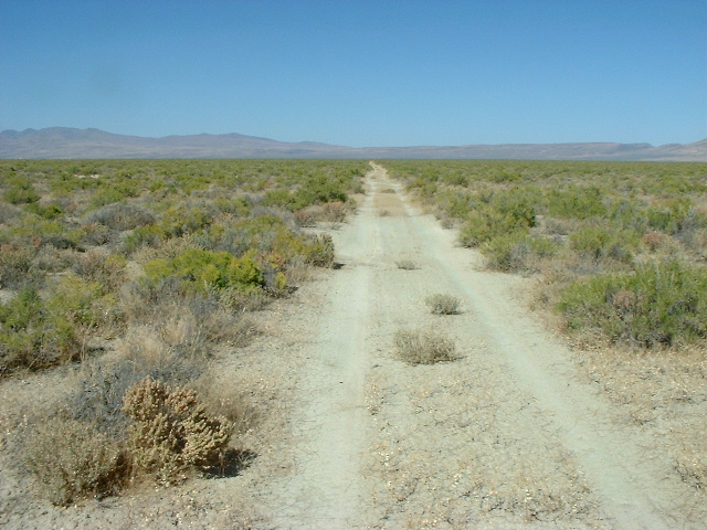
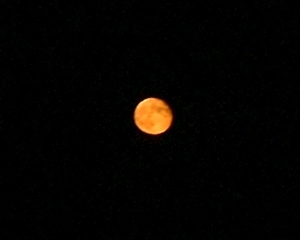
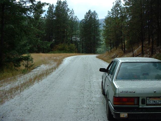
I found another way to make car travel more interesting. Why not take gravel roads, at night? Yeah, that's the ticket! After taking Hwy395 all the (damn) way up to Alturas, I "hung a righty" over to Cederville (great little town), then lit out to the east, for 60 miles (had I went expeditiously, which I didn't) of gravel and dirt. Riding through the desert night, off-pavement, is a recipe for bliss, unless you happen to be one of the several kamikaze jackrabbits whose cosmic journey my car tires assisted. The almost-full moon rising was amazing, with a shockingly bright Venus setting on the opposite horizon. I stopped on a high ridge and whipped out the guitar, and wrote some lyrics to my newest song. Unhappiness, we cast you out!
|
|
|
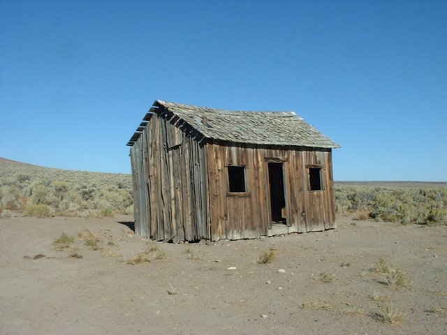
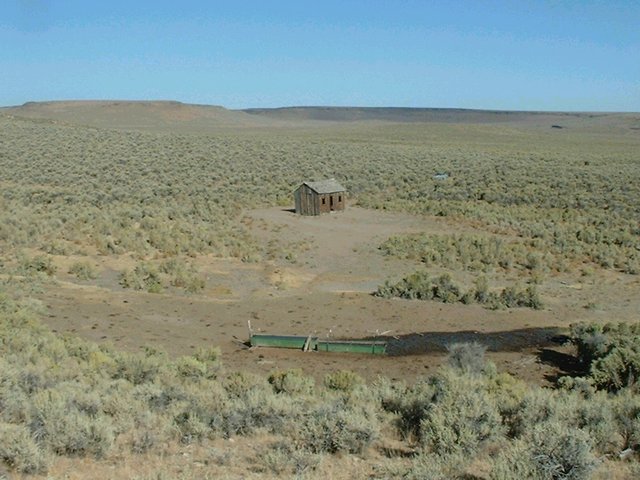
While blitzing through the desert darkness, I ran afoul of the Sheldon National Wildlife Refuge. Wildlife Refuges seem to be places where hunters are restricted, with the aim of creating better hunting (?!?). Which is fine, hunters and hunting are okay by me, but the restrictions were not so fine. Camping was limited to designated campgrounds, not my personal preference. After 20+ miles of driving around the midnight desert looking for a good place to hang my hat, I ultimately ended up near the building pictured above. It's the same familiar old story - while scrambling around looking for a good spot, and lamenting the crappy results, I accidentally end up in some fantastic little piece of heaven. How much of life is like this?
|
|
|
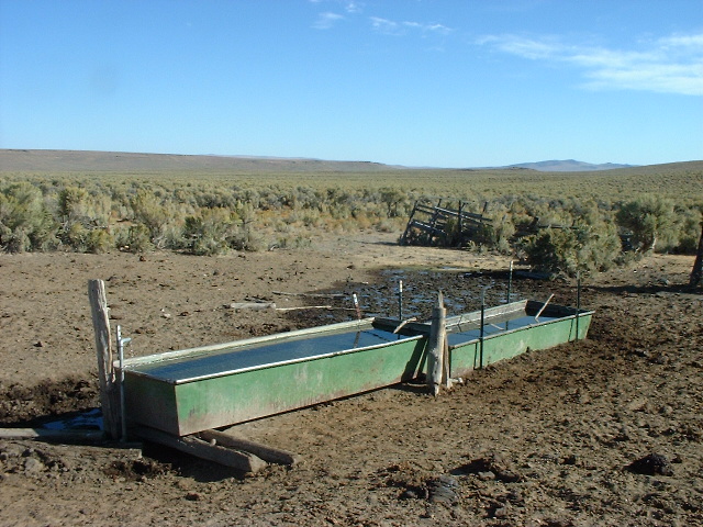
The reason for reason. The cabin above, likely the only one within 100 square miles, is here because the spring is here. The troughs are fed by the spring, and the cattle by the troughs. Cows, and cowshit, abound. There was also a piled stone foundation, inset into a hillside, from some long-gone shelter that may have predated the cabin.
|
|
|
Looking back, at the start of my customary 1-2 hour morning walk. I rounded the nearest hilltops, watching the local antelope (or they, me) and cattle. During the night, the coyotes were so loud and close and vociferous and distributed, some sounded just like yapping dogs. I had slept out anyway (as I did each following un-hosted night), tents are a lot of trouble.
|
|
|
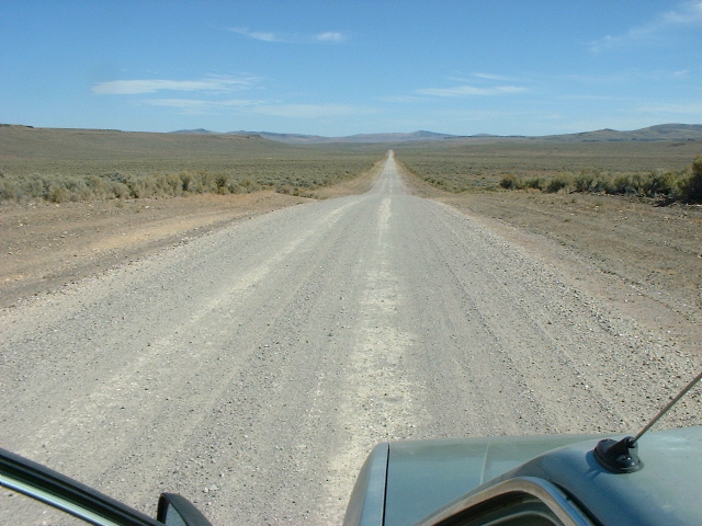
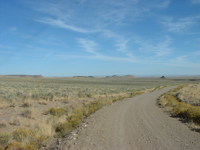
How'd you like to start your driving day like this? Feel pretty good, no? First I had to drive the couple of miles of dirt two-track and minor road to reach this big gravel thoroughfare. Then, it was happy camper cruising time. Or so I thought...turns out a little detour I made to a spring would cost me dearly. While motoring down some two-track (dirt road with bushes running down the middle), I ran over a hidden rock. The car went "bam!" and jumped up, and when I stopped to see what had happened, there was a soccerball-sized rock, 15' down the road from its initial ambush point. But no apparent damage...and the desert spring was kind of boring, not the large, hot bathing pool I was fantasizing about.
|
|
|
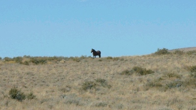
"Wild, wild horses, could drag me away." These guys are commonplace in Nevada, usually seen either as one or two (males, I think), or bands of 6-30. They usually look wary, but happy, except for the boys, who can be a bit cranky.
|
|
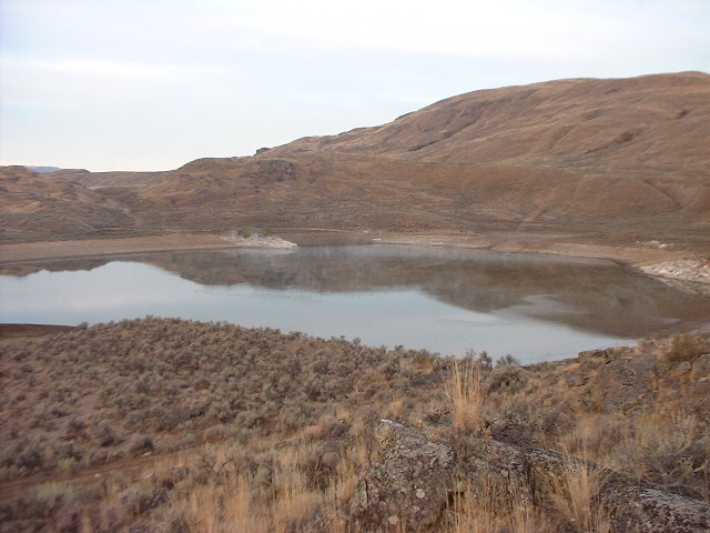
Back on the pavement, motoring towards Denio at the Nevada/Oregon border. This lake (the creatively named "Alkali Flat") is beautiful but not hospitable - like most desert lakes, it is shallow and briny and cowshitty. Though easily a square mile in size, it might have an average depth of only 6'. But don't get me wrong, every lake in the desert, like every tree (and certainly every spring), is miraculous
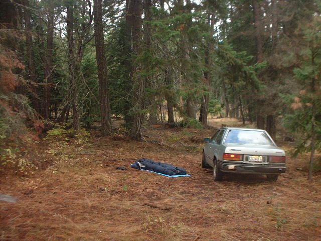
After stopping at the library, gas station/bar/store, and store/bar/restaurant in Denio/Denio Junction ("my momma told me, you'd better shop around"), I headed north on Hwy205, and pulled off onto a little dirt road for a bathing opportunity in a small cold stream. Once reborn, I jumped in the car and...it wouldn't start. I managed to push it up over a little rise, then roll-started it easily down the dirt road. Hmmm, what the? Had I left the lights on, or had the battery or alternator/regulator failed? Stopping in at the nearest little town of Fields' restaurant/store, I loaded up on groceries, and learned that the nearest auto parts store was two hours away, in my choice of three directions. Exercising some rare discretion, I decided NOT to take the backroad route to Boise, but instead to head north for Burns and assistance.
|
|
After an afternoon spent futzing with the car, it was clear that the alternator was working perfectly, but the battery wouldn't take enough of a charge to run the radio. That meant (probably) that either the regulator (built into the alternator) wasn't charging the battery (is this a real possibility?), or that the battery had died suddenly and totally. Hoping it was just the battery, I proceeded towards Burns. As night fell, I investigated several possible backroad camping possibilities, at least one truly stupid, and managed to not stall the car, or to (amazingly) push it successfully when I did. My goal was to find a place where I could sleep comfortably, but could still roll-start the car in the morning. Now, finding a spot at night is hard enough, but this was harder still. When I finally, almost, succeeded, I stupidly (there's that word again) threw it away by needlessly attempting a reverse-gear roll-start ("gee, maybe I should try that - yeah...Shit!!!"). Turns out that roll-starting in reverse, while a good last resort on the pavement, doesn't work nearly as well in loose conditions as does 3rd or 4th gear. I managed to turn the car around and finish the slope in forward gear, but the car wouldn't start. Despite some big, big fun pushing it up the hill a ways, and then back down again.
So there I was, on the road pictured above, just below a nice grade, at night, with a totally dead battery. Needless to say, I was not patting myself on the back. I figured that, the next day, either someone would drive by and give me a jump-start, or I'd walk the four miles back to the highway. But for the moment, it was Miller time, and that was all there was to it.
The next morning, someone did come by. At first light I had popped the car's hood, so that passersby would know I needed help. At 8:30AM, I awoke again to hear the sound of a truck pulling away. For a laugh, picture me running barefoot through the desert after a receding vehicle, waving my arms and yelling for help. Good times, good times. Fortunately, another truck (on the way to meet the first at a jobsite) came by shortly afterwards, and with the help of Tim the ex-paramedic, I was back on the road.
|
|
|
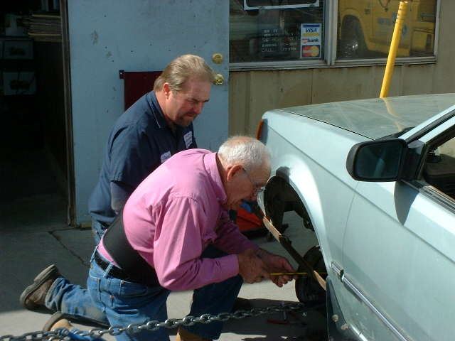
In Burns, I got about the business of car repair. After some battery shenanigans at one shop, I went to the only auto parts store in town, and bought a new battery, which worked like a charm...except that, there were other problems. The rock hit had taken out my battery, but it had also bent the frame, and Yekel's repair shop (that's Yekel, above, with his friend Norm in the pink shirt) told me I needed a new front axle (CV joints). They ordered the parts for next-morning delivery (impressive, and not that expensive, given the remote location), and I disappeared up north into the mountains for a little, in the words of Elmer Fudd, "west and wewaxation".
|
|
|
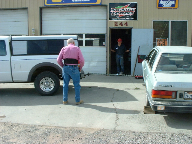
The plot thickens. Turns out the frame was badly bent, and the new axle wouldn't be sufficient. Yekel was at a loss, but his friend Norm, aged 83 and super-knowledgeable in the ways of machines, suggested a bold alternative: the "tractor-pull" method of frame straightening. A wild and impertinent move, just like I like 'em. They spent all afternoon trying to pull my car to pieces, while everyone who witnessed the attempt, laughed. I stayed out of the way and played guitar, hoping this would lower (not raise) the final bill.
|
|
Amazingly, they seemed to have fixed me up, but good. Setting the alignment by driving the car and seeing which way it pulled, they took my $480 ($260 for the new front axles/CV joints, a good price, and $220 for the frame straightening) and sent me on my way. The front tires, which were pretty much dead when I left the Bay Area, were now toast (burnt toast), from the axle problem. The steering wheel would start shaking above 62MPH, but, what the hell - maybe it was time to start driving more slowly, anyway? Oddly, this speed limitation wasn't really an issue until I got back on an Interstate, in Northern California, nearly two weeks later. (Through 2000 miles of northern Nevada, Oregon, Idaho, Washington, and back, I think I did only about 10 miles of so-called "freeway"...)
Heading west out of Burns, I tried to make up for lost time, driving through eastern Oregon, then west central Idaho, under cover of darkness, listening to the Angry White Man radio programs to keep from falling asleep. (This genre of radio was a frequent companion through the trip, kind of a high-tech, American Madrasas kind of thing. But instead of constant angry ranting about Americans, as with some Madrasas in Pakistan, and some Arab satellite TV, the ranting was at the expense of left-wing and urban America. Programming minds for anger and hate, popular in many cultures...)
|
|
|
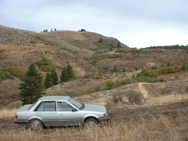
After 20+ miles driven out of the way, through the Idaho midnight, I ended up camping here. Worth it, wouldn't you say? This is some quintessential non-forest, non-desert Idaho: brown hills, with even browner dirt and volcanic rocks protruding occasionally. Very beautiful, fairly rugged, definitely a Sportsman's Paradise. (For you younger and/or city types, "sportsman" means hunter or fisherman, and used to be somewhat synonymous with "conservationist". How times have changed, but less so in rural America.)
|
|
|
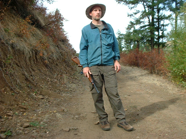
Doing my duty, in the fine Idaho tradition. I haven't hunted in 20 years, but an observer might not be able to tell. Unfortunately, in front of me is a locked gate, and a cool little bridge. Dutifully, I trespassed for awhile, but didn't linger. With deer season imminent or possibly arrived, I felt a little cagey.
|

|
|
Road cows, always a pleasure, occasionally a nightime driving hazard. I took the riverside gravel road back to the pavement, then got about the business of heading north towards Elizabeth and Leroy's place, near Moscow, ID. Unfortunately, the world was too wonderful, and I didn't make much progress. The county seat, Council, was much nicer than I had remembered from two years before. Small grocery stores, still common in towns ignored by the predatory chain behemoths like Safeway, are always a local pleasure. Seeing a forest map posted outside the ranger station in town, I did what I do best, succumbing to distraction, and headed up into the mountains of the Payette National Forest to the west. What's the rush? (Too bad I was almost out of gas...)
|
|
|
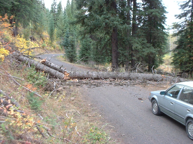
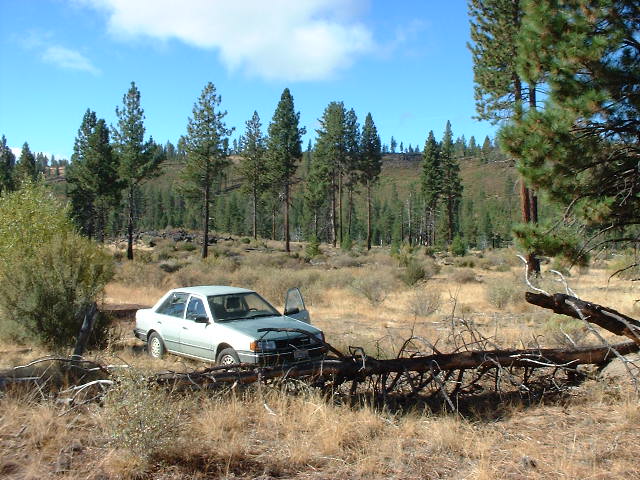
After a couple of hours walking and driving through the mountains (I saw one car), I opted for a possible "shortcut" back to civilization. Things got a little hairy, what with the heavy cold wind developing, the disorienting cloud cover (mapless navigation being easier with a reference point the like sun, moon or stars), and my poor fuel state. After some backtracking, I found a road that looked like it might be heading the right direction (down), and after a long ways, ran into a wee little obstacle.
|
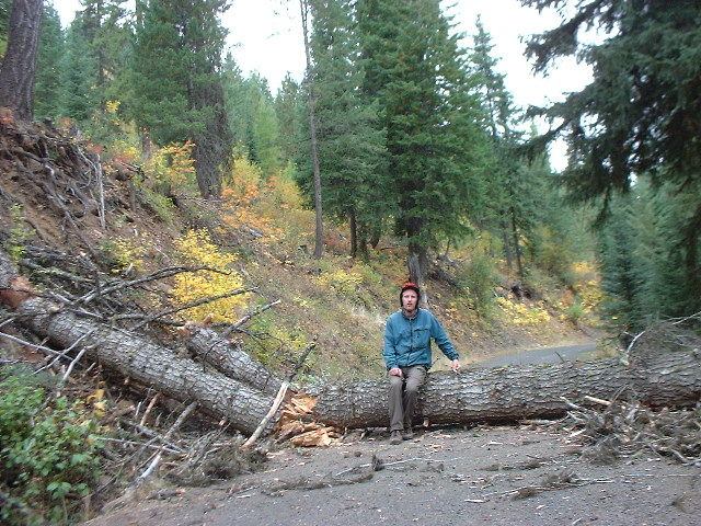
|
|
I went to work trying to clear the obstacle. I felt that, if I could get past this, it would be one of the greatest things I had ever done. The trunk was pithy, and thus much lighter than it might have been. With a strong 6' steel pole, I could have done it. Without...I cleared debris, broke off protruding branches, levered it out of the way a little, and was just beginning to push with my car, when help arrived. If I had to, I could have done it. I think.
|
|
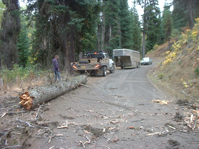
Redneck Rescue. Two really nice older guys drove up, and fixed the problem promptly. (But not without, in the fine redneck tradition, breaking an electrical coupler under the truck's trailer hitch first.) That's a large sweet border collie on the truck's bed, and there's a fully saddled horse in the trailer. These guys were ranchers, up in the mountains to check on some cattle reported to be where they oughtn't. With my gas tank nearly empty, and the prospect of an hour of dirt-road backtracking all the way back up and down the mountains behind me, I was damn grateful to make their acquaintances.
Time to make time. The great little village of New Meadows, a hick town with more than a hint of ski/golf culture, was cold and windswept. Really icy, "Holy Shit!" kind of wind, I felt sorry for the Harley guys who rode through town. After a stop at the library for e-mail, and the store for much-needed gasoline, I pushed north as the rain began. The route here is striking canyon country, first alongside the Little Salmon, then the real Salmon rivers. At the "top" of the canyon, site of one of those famous battles where the Indians won, lies the cozy little village of White Bird.
Historically, northern and southern Idaho have been separated by geography. To the east are the mountains, to the west the area prosaically named "Hell's Canyon", and in the middle, the Salmon River Gorge. (Eastern Oregon/Washington, and parts of Idaho, are characterized by huge north-south river canyons.) A railway was never considered economically feasible, and a good modern highway (with a huge bridge that passes literally above the town of White Bird) was only completed relatively recently. I drove up the old Hwy95, completed in the '20s I think, and it was quite the ride, through the foggy rainy night towards distant moving headlights on the new highway. I had to wonder, "why is this road so wide and well graded, but so damn winding?", and the answer was, for 20 or 30 years, this was the way to get from southern to northern Idaho. Cool.
|
|
|
I woke up to rain on the face, then jumped into the nice dry car. The previous night, after climbing out of the Salmon River Gorge, I stopped in the cool little city of Grangeville, then headed east for a place to sleep and a novel approach to my northwestward destination. Winding down from the Camas Plateau into a canyon (Idaho!), then back up the other side into the mountains on a little gravel road, I eventually found myself on the Elk River Wagon Road, once the main route to the mining boomtown of Elk River. A road feels different, when it has 100+ years of frontier history behind it. At any rate, it took forever to find a good campsite (canyon country is always long on beauty, short on usable roads), but I did, and the rain stopped too. At least, until morning arrived, when I took the picture above.
|
|
|
The "road" I camped on, could this be another "shortcut"? Well, the road went down and down, which tends to mean a way out, but it eventually petered. (Funny expression...) Unfortunately, in planning for my Great Northwest Adventure, I had somehow omitted the packing of a raincoat, rainpants, or waterproof boots. Now I know. Actually, Western Septembers tend to be mostly warm and sunny, and when I asked folks farther north if they had gotten any of the rain or freezing wind, they looked at me incredulously. (Of course, people often do that to me...)
|
|
Around the village of Clearwater, once a main waypoint on the Elk River Wagon Road. I had found my way back to the pavement, via one stretch of road that was frightening, a wet muddy rocky section where I nearly lost control of going down, and could never have made it back up, until it dried anyway.
Back on the highway (Hwy12), I headed north along the Clearwater River. This was within the eastern edge of the Nez Perce Indian Reservation, but this Rez is mostly white-owned, and is one of those (many) reservations that aren't obvious when you're not looking at a map. My friend Leroy explained that this was due to the Dawes Act of 1887, which allocated ownership of tribal land to the individuals of the tribe, the result being the gradual sale, parcel by parcel, of most of the land. The Nez Perce lands include the Camas Prairie, a large area of rolling highland prairie above the surrounding canyons - a characteristic terrain feature of eastern OR and WA, and western ID.
It was kind of nice to be touring this area on a cloudy, rainy day, it felt very authentic. (Some local festival goers were not so happy about the unwelcome rain.) The towns felt good compared to some of their California equivalents, wherein much of the traditional logging activity has been supplanted by the newest industry, meth production.
|
|
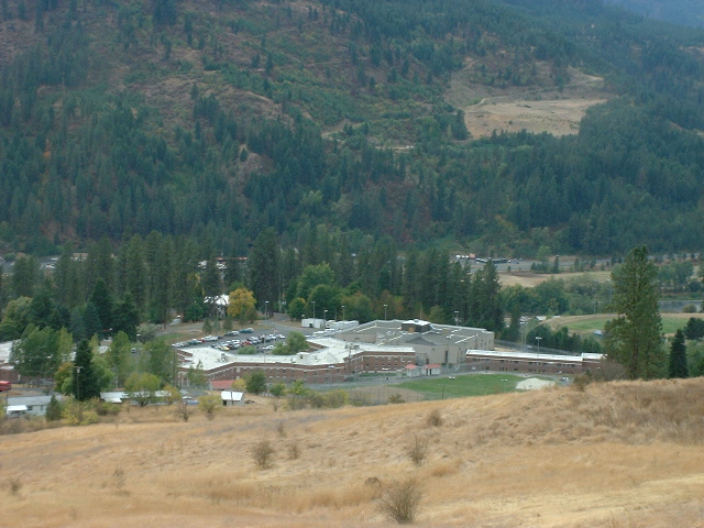
The prison at Orofino, seen from above. What tour of America would be complete without a visit or two to the prison-industrial complex? Believe it or not, that athletic field at far right is part of the local high school. Maybe they share the facilities. It shouldn't have been such as surprise - here in Oakland, it quite often seems like the public school system is just a branch of the so-called "correctional" system.
From Orofino, I headed straight north, taking the rugged and partially-gravel "shortcut" up to Elk River, like Elk City, another old mining town. I stopped on the way to play around on a suspension bridge, with few fences or other obstacles to a young man's adventures. Enjoy it while we can.
Stopping for a snack, waterbottle hair washing, and a little recreational recreation, I noticed that one of my tires was almost completely flat. Out came the electric tire pump (thanks, Mom!), and that pump became my constant companion for the rest of the trip. (One front tire was leaking from the Nevada rock incident, another would later take a nail.) Once pumped up, I continued north, when I saw what seemed to be a really homey-looking young cow, with two calves, up on an impossibly steep little cliff above the road. Moose! Combined with a freezing swim a little later, to the sounds of classic Neil Young wafting across the lake, my day was now verging on the excellent.
|
|
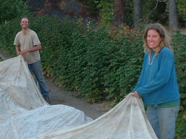
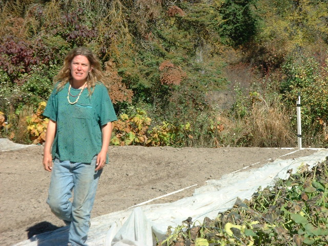
Elizabeth and Leroy, covering the crops to protect them from the freezing night. (I used to wonder why Elizabeth literally ran around so much, until I realized, that's what you have to do when you're a small organic farmer in northern Idaho.)
When I arrived at Elizabeth's house, I had a little fright. My letter that I sent two weeks before, saying that I would be coming to visit, was still in the mailbox, unopened. Shit! Had I driven 1200 miles, just to miss them on some kind if vacation or travel? Figuring I'd spend the night and see what happened, an hour later they drove up, returning from the week's marketing day (Saturday). Whew!
|
|
|
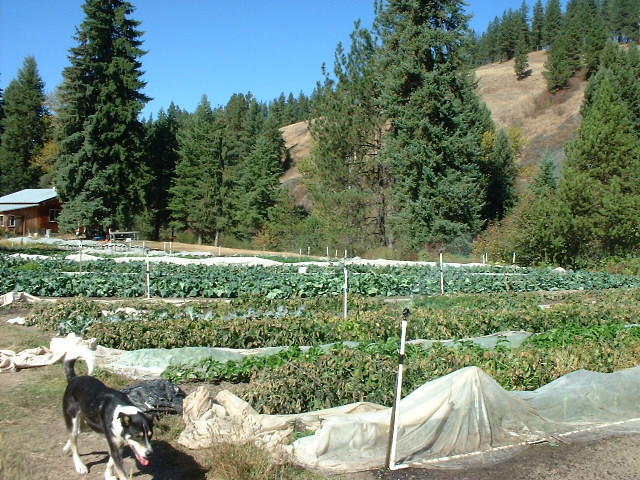
Mister P, who (in Elizabeth's words) "works nights", making his daylight rounds. You can see the rows of vegetables of various kinds, the house at the left, and the creek in that gully at right. Water is pumped from the creek to feed those white irrigation sprinklers. Not visible is the highway at far left, the one pit in the cherry of her homestead. Life is imperfect. She has electricity now, and a phone of sorts, but still no running water or indoor plumbing, or refrigerator. By choice.
|
|
|
A farmer's work is never done, in summer at least. In winter, she switches gears, focusing on roadkill, tanning, basket weaving, and, no doubt, recovering from summer.
|

|
|
Leroy working on a science project. He teaches high school physics, and was working on a "nomen", a stake (of re-bar, in this case) used in the 2000-year-old experiment by Erastothenes in Alexandria that proved the circular nature, and the actual diameter, of the Earth. No easy jobs, those...
|
|
|
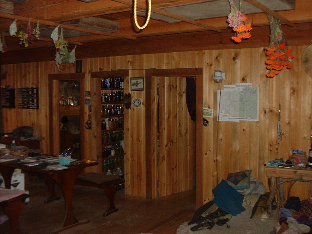
Inside Elizabeth's house. Pretty cool, huh? Drying herbs were everywhere, hanging from the ceiling.
|
|
|
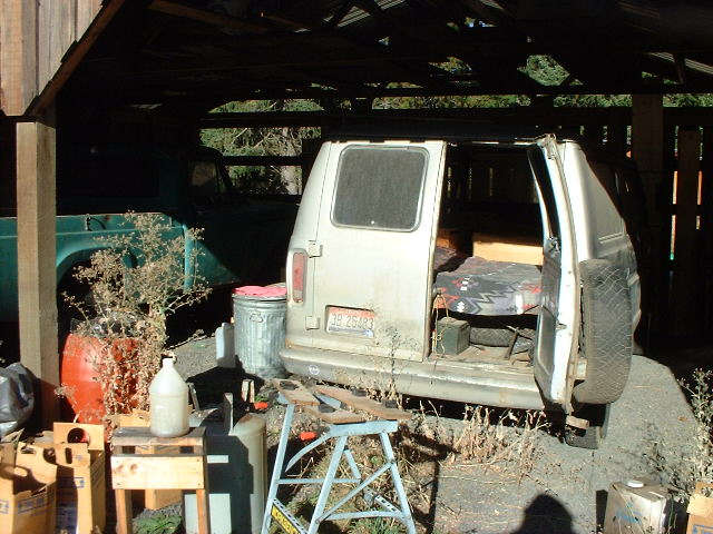
The guest room. Before the new dog, Mister P, arrived, Elizabeth used to drive the van out to the center of the field, and sleep out there to guard the crops from foraging deer. Now, the van is available for transients like myself. In the foreground of this picture are visible some of the paraphernalia of bio-diesel, which they run in the newer, larger ex-passenger van they use for marketing.
|
|
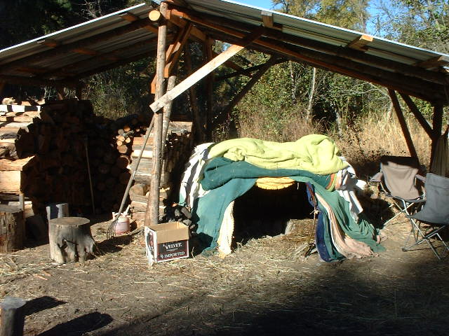
The sweat lodge, down next to the creek. Leroy and myself "sweated" on my last full day, which was quite a cool ordeal. The drill involves heating rocks in a bonfire, then putting the rocks into the pit in the center of the lodge. In the total dark of the lodge (with the door closed), Leroy sprinkled water on the rocks and chanted and MC'd the ceremony, until the heat became unbearable and breathing difficult. Then, we ran outside and jumped in the freezing creek. Rinse, and repeat - four times, one for each direction of the compass.
The next day, I was on the road. After three days of hanging around the property (including Redneck Volleyball at Pokey Creek one afternoon, really fun but exhausting), and three nights of playing guitar in the house, followed by sleeping in the (sub-)freezing van, it was good to stretch my legs again. Next stop: Washington.
|
|
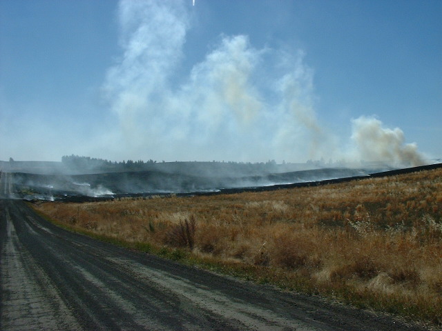
Controlled burns on the Coeur d'Alene Indian Reservation. I guess this is a standard part of agricultural practice here. Fires were everywhere that afternoon.
After leaving Elizabeth's house, I meandered towards Spokane, taking the back roads. First stop was St. Maries, "town" for Elizabeth and Leroy, and a pretty nice little burg. I thought I might buy some rural-type clothing, like a quilted shirt or "sheepskin" denim jacket, but found no suitable victims, despite a lot of effort. St. Maries is a logging town through-and-through, they still use the river to transport logs, and claim that said river (if I recall) is the highest navigable river in the world (3000'?).
|
|
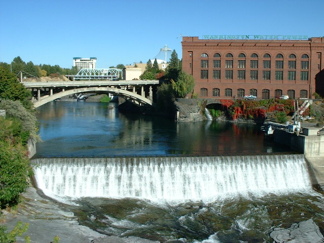
Spokane is a bit like a city out of time. More Milwaukee than Seattle, driving through town while listening to the classic rock station was damn poignant. When I spent in time in this neck of the woods, those songs still had that new car smell, and what with this whole area just generally lagging behind The Coast(s), it all felt all right. The city seems to have something of a bad rep, for crime and a big homeless problem, but it felt good to me, and improving (gentrifying - a little of which can be a good thing).
I tried to find The Flour Mill, an old mill converted to a mall, where my dad and stepmom used to be part of a co-op pottery store (they were potters at the time). I wasn't able to find the building, but it looked a lot like the old powerhouse pictured, and some locals told me it was still in business. I was able to stop at the library main branch, oddly on the 2nd floor of a big downtown building, and I reached it by walking through a Neiman Marcus (or some such) store. I also stopped at a couple of music stores, and managed to find a capo for several bucks cheaper than in the Bay Area. Worth the 3000-mile drive?
|
|
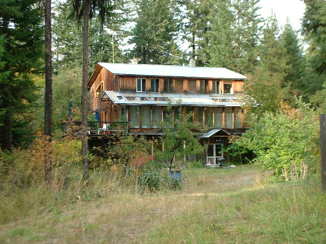
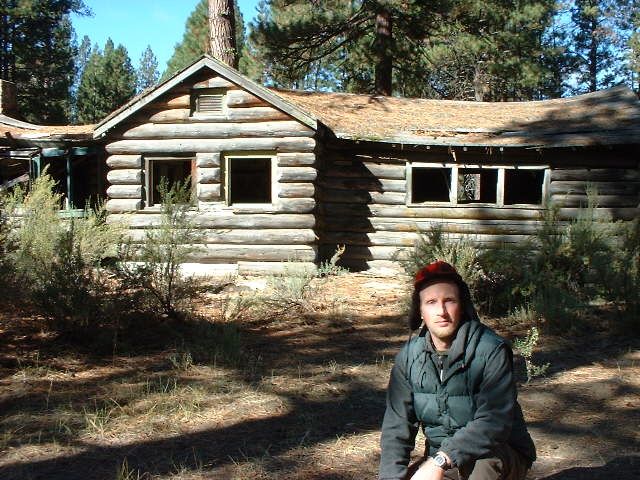
Elinor and Philip's house, near Colville, WA. My dad's family lived next store, from 1979-1985. We bought 20 acres, cleared some forest, built a house and a barn, and lived the dream. Well, they lived it, I visited it, and being young and foolish, wanted more to be back with my same old friends in Berkeley. Now I know better, and am willing to drive the 1200+ miles each way to prove it.
Not long after building the house, we sold the back 10 acres to Elinor and her then-husband Tom, and they built the house pictured. (Our house is shown below.) The two houses feel very similar inside, and coming back here feels like coming home. Very emotional, and I'm terribly grateful to Elinor and Philip for sharing with me.
|
|
|
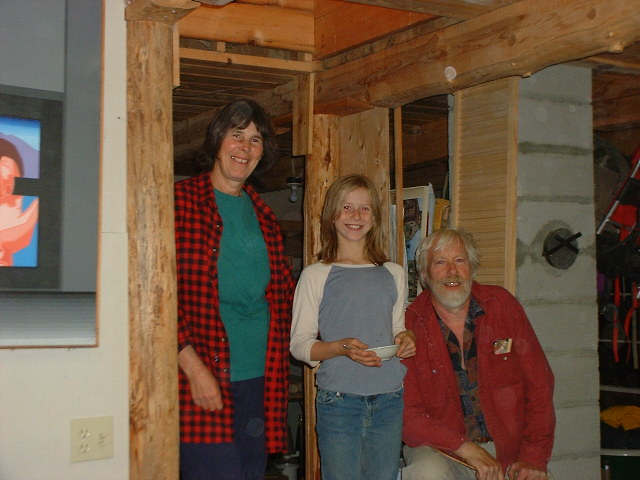
My generous hosts, along with the new neighbors' (the people who currently live in "our" house) wonderful kid. This picture is in the basement, and shows some of the signature design elements of both houses: Rough-hewn log beams, tongue-and-groove floors (seen here in the ceiling), plasterboard walls, and the square cinderblock chimney. Not shown is the home-made ping pong table, on which both Philip and Elinor are demons of sport.
|
|
|
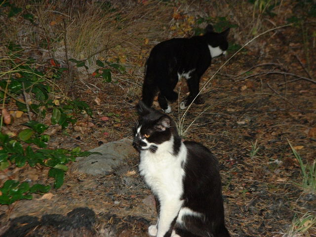
The newest members of the family, Lilo (formerly Lila) and Sym. These young litter mates sleep in a pile, and they happily went on walks (my main activity) with me, including climbing "the rock" next to the house.
|
|
|
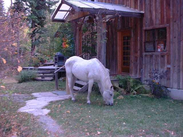
"Funny, I don't remember seeing this when I left on my walk..." The neighbor girl rode up bareback (the bridle was nearby), and when she left later, the horse was nowhere to be seen. Must have gone home, we figured....We had had a horse (or two, and a cow, and lots of sheep and chickens and the occasional well-named swine) for awhile, which my sister Julie loved, but I didn't ride that much, because of the hassle of saddling-up and post-ride grooming. (Silly boy...) I did enjoy the Jeep, though.
|
|
|
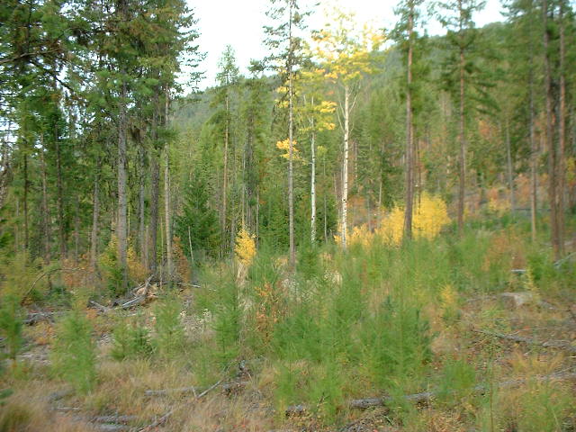
The logged area behind the house is coming along nicely. Maybe five years ago, the lumber company that owns much of the mountain behind the property, came and did what logging companies do, every 20 or 30 or 40 years. But it's really starting to come back nicely, and looks way better than on my first visit, four years previous.
|
|
|
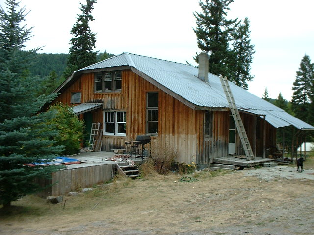
"Our" house. My dad. stepmom, and first three half-sisters lived there, from '79-'85. The house has changed a bit since then: externally, the hot tub at left is new, and the "front" deck no longer wraps around under the living room windows. Inside, my dad's tradition of drastic room re-arrangement has continued, the whole front of the 1st floor now being a living room with a fireplace and hearth (we had had a pot-belly stove, I remember drying wet mittens above it during winter), changes in the utility room/my most recent bedroom area, and some new walls/doors down in the basement. At least the 2nd floor looked the same...though there's now a little room half way up the stairs, where the water heater lives.
|

|
|
Some parts of our old log fence remain, between Elinor's house and ours. I remember how the cow and/or sheep would get past this fence on occasion, though the smallish sheep pen's fence must have been quite a bit tighter. My dad also built a "mobile" enclosure, a small square pen mounted on old bicycle wheels. Put some sheep in, and you could "mow the lawn" pretty effectively. Got to keep it moving, though, sheep are very effective grazers, and given time will eat not only the grass, but the seeds for the next generation of grass.
|
|
Dunn Mountain, as seen from across the valley. Not much to look at, but that's what the (lower) northern shoulder looks like, and it's pretty impressive seen in person. Our house being at the base of this mountain, we couldn't really see it's true size. I climbed this puppy on my last full day, a grueling ascent, with a comically minimal overnight pack. But the cold wet fog was billowing in, and I chickened out and headed back down. Which was just as well (to say the least), it rained cats and dogs that night, and my comically minimal plastic tarp would have been severely challenged in keeping me dry.
I spent four days and four nights with Elinor and Philip, walking the area to relive (recapture) lost memories, visiting "our" house once, and going to town with Elinor to see how the locals lived it. (We went to the newly-built high school where she had worked, and the well-equipped library, and did errands, and...) The old natural food co-op is no more, though it had still existed four years before - I remember there was a funny comic strip on the bulletin board, a customer saying to the grocer, "Hi, I'd like to make a down-payment on an organic tomato". I think Elinor said there was a new co-op over in Kettle Falls or somewhere (past the damn Walmart), and that there were two natural food stores in town (one across from the damn Safeway).
|
|
Dirt-roading through a hailstorm. Yeah, there are definite advantages to traveling by car. And disadvantages: my windshield wipers flew south during the hail (wiper arm's armature came off the motor's armature, lots of arms involved), and by bike I certainly wouldn't have had that particular problem. This picture is from another "shortcut", up in the mountains south of the highway from Colville/Kettle Falls to Republic.
Republic is quite a town, half cute and wonderful, half squalid, with it's best days a hundred years behind it. The local independent market was large, well-stocked, cheap and entirely pleasant. But the clientele was a little frightening and depressing. This logging/mining/company town, an improbably small county seat (county population: 3000?), seemed very poor (kind of like Kettle Falls, with its combination liquor store/library, but set in the mountains) and hardscrabble. Kind of Northern California. One barometer is the women - we men often look a little (okay, a lot) rough around the edges, but many of the women I saw had that look, or those looks, that say "squalor" to me. There was the thin attractive brunette, but with that gaunt, meth-lab air about her. I didn't notice much of the classic missing-tooth country gal syndrome, but there were (as always) a lot of heavy girls, and more than that, a kind of cherubic unhealthy glasses face look, which stood out. And then there was the woman walking like a ghost through town, in a swaddled cold-weather pseudo-Indian daze. I apologize for the frank talk here, but I'm trying to convey the feeling of the town, which was more than a little disquieting. Interestingly, this area was once part of the huge Colville Indian Reservation to the south (see below), but the northern portion of the Rez was stolen (de-Rez'd?) when the area's mineral wealth was discovered.
|
|
Stealth camping on the Colville Indian reservation. Heading west from Republic, I had eventually come down to the Okanogan River Valley, back to the land of canyons, agriculture, and illegal immigrant labor. Oh, joy. With night falling, I drove through the substantial towns of Tonasket, Omak, and Okanogan. Night sucks, because you can't see the country you're passing through, but in town, night can be an advantage. The kids come out, the vibes get heavy, and the visual contrast makes for memorable, visceral touring.
Driving through the night, wondering where the hell I would camp, I started to look for suitable unimproved roads leading onto the Colville Indian Reservation. This Rez is huge, in fact stretching almost all the way back to Dunn Mountain from whence I'd come that morning, but I'd never set foot on it. Was it really Indian land, or mostly white-owned? Whatever it was, it was definitely sparsely populated, and I headed in. The picture above shows what I found when I awoke the next morning. Stark and beautiful, extra-gray in the early morning light, it looks very Idaho, but different, very central-Washington.
|
|
Jetbird Lake, or so I called it. I awoke, from my sovereign nation trespass camping flat spot in the power-line road bivouac, to hear what sounded like a pickup towing a trailer, rattling down a rough gravel road. Which is exactly what one would expect to hear, here, and cause for considerable concern, given the little tribal land trespass issue, which on some Reservations is a serious matter. And the sound seemed really close, based on its rate of travel (change in apparent direction). And then it happened again, and again. What the?!?
Do you see the little dark line(s) in the middle of the lake? Those are birds, many hundreds of them. All morning, they flew in, in large flocks, sounding like a truck on a gravel road. As they wheeled around the lake in their approach, the sound doppler-shifted and whooshed, like a fighter jet maneuvering low. The sound was almost beyond belief, on this still-air desert morning. Almost spiritual. I spent a couple of morning hours walking through the grey rocky outcrops and small canyons with poplar enclave valleys, trying not to scare the cattle.
Back on the highway, past what looked like some kind of NASA space tracking station, I headed south down the mighty Columbia River's valley. This seems to be apple country, and Mexican laborer country. I detoured through Chelan, a weird little (big, actually) resort town at the base of Lake Chelan, an improbably long and large artificially-raised lake which reaches 50 miles NW up-canyon to North Cascades National Park. A extraordinary fjord, except that it's nearly 500' above the Columbia River, and 1000' above sea level. Apparently, the dam only raised the level slightly, so, somehow, this amazing lake is natural, with its lowest point (greatest depth) reaching down to nearly 500' below sea level. Look at a map, you'll see the amazingness.
|
|
At the top of Old Blewett Pass, west of the major city of Wenatchee, which sadly I missed seeing. Instead, I headed up into the mountains, for what strangely is one the main routes south from Wenatchee. Rugged country. But instead of staying on the crowded two-lane Hwy97, I took the old highway (15MPH instead of 55MPH, which is my preference anyway), with almost no traffic. At the top, I detoured to the muddy rainy dirt roads pictured, but in truth there didn't seem to be as many roads as I would have liked. Steep mountains, of which the Cascades are surely counted, are like that - long on beauty, short on roads.
Back in the low country, I was impressed by the college town of Ellensburg, then took the slow scenic route down Hwy821 through the beautiful Yakima River gorge (interstate, fuck you). Yakima itself seemed very Spokane, but more squalid, very California Central Valley. (This is grape/wine country, ag country, and police, courthouses and jails are prominent.) As dark arrived, I hurtled (but not on the interstate) SE along the edge of the huge Yakama Indian Reservation, stopping for awhile in the cool half-Indian, half-Mexican town of Toppenish, then made a dash through the scary night rain, across the Rez, for the Oregon border.
|
|
Car-camping on the back side of the Cascades. Once again, it had rained all evening, but at midnight the rain stopped, and some sky peeked out. Why not sleep exposed, without the tent? Worked for me, again.
Having left the Yakama Indian Reservation, and crossed the mighty Columbia River into Oregon, I drove south through the dark night. With heavy (rainy) cloud cover, all was dark, but the country here was likely typical high rolling hills/plateau above the river's gorge. Departing the highway at the sleepy (and a bit strange) little village of Dufur, I headed west looking for some National Forest refuge. After an hour of confused gravel-road wandering (I had to break out the compass to try and get oriented), I got past the wide spot in the road known as Friend, then headed up into the mountains. Whew! Another post-midnight camp, good lord, but at least the beer tasted divine.
|
|
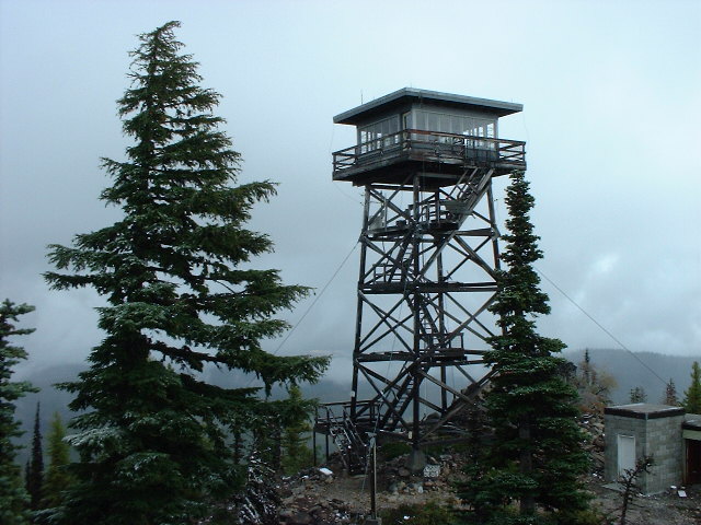
A mountaintop forest fire lookout, once a common feature in the American West. Nowadays, in the era of aircraft and satellites and effortless car travel, many lookouts seem to have been abandoned, but this one was still manned, by handsome young cityfolk couples, it appeared. Not a bad way to spend a month. But the road up to the lookout was really bad, a little beyond what my car should have tackled.
After leaving camp that morning (which followed the obligatory hour-long walk), I thought I'd take a "shortcut" up into the mountains. Might have worked, but didn't, my map failed me many times during this and the previous day. I met some cool older hunters (deer season was going hot and heavy, men with rifles were plentiful) from Astoria ("fishing capitol of Oregon's north coast"), who straightened me out. The got a laugh when I told them my Cheech and Chong joke, involving the following verbal driving directions: "...go 10 miles, pull into the Chevron station, and ask the attendant, 'Where the hell am I?'". I love using that line, when banging down (or up) some nasty mountain/desert road in my poor little car, and I meet some guys in a monster truck or jeep. And often, I really don't know where the hell I am. I pity the next generation, who with their GPS's and cellphones (which currently still don't work in the country), won't have that essential experience known to the last couple of billion years of life on Earth, the feeling of being lost, and on your own.
Heading back to the highway (Hwy97), I shortly...left the highway again, for a little detour through large Warm Springs Indian Reservation. I really liked this Rez, there were a lot of Indians (I stopped for supplies at the Three Warriors Mini Mart), but not many people or communities. Like other desert reservations, where the land isn't good for agriculture (and thus not purchased by white farmers), Indians still abound. With Mt. Jefferson towering (and glowering) to the far west, and rugged canyon country, this was a really cool-feeling Rez.
|

|
Central Oregon is nothing if not "canyon country". This is Lake Billy Chinook, west of Madras, and likely the product (or "beneficiary") of several giant dams in the area. The small road I took, on the edge of the gorge, was understatedly amazing.
Then back to the highway again. Redmond was overwhelmed by traffic, the town using the common Western traffic plan of making the old Main Street one-way, then making the next biggest parallel street (Court Street, State Street, Front Street, etc) one-way in the other direction.
Next stop, boomtown Bend, which really pissed me off. The city reeks of new development, being all traffic circles, fake-looking red rock landscaping, nuevo pseudo-old apartment buildings, and pennants advertising how wonderful things aren't really. The traffic system was very effective, but the drivers were super-aggressive, more Seattle than Spokane. At the library main branch, they wanted me to make an appointment to use a computer, for the next day. No thanks, I'm outta here! (To be fair, my visit coincided with rush hour, and maybe I had delayed lunch too long and was cranky. But I kept eying the giant corpulent volcanos to the west of town, hoping for a little action. Which may someday come - look at a map, and you'll see the swath of lava that flowed just south of Bend, so recent that the black cinder piles haven't a hint of vegetation on them yet.)
|

|
Frosty morning in south-central Oregon. Pushing south from Bend, I drove through the late afternoon and into the evening, stopping for awhile in a bit of forest next to a railroad siding. I thought I would pull into the forest and make a little dinner, but ended up next to a freight train that was stopped at a red light (no kidding). I climbed one car, but didn't linger, being uncertain how fast the train would accelerate, and having once years before nearly taken an accidental ride to Reno for this reason. (Jumping off a moving train turns out to be a bit hazardous.) When the train did start moving, I was astonished by how fast it took off, but shouldn't have been - all the cars seemed to be empty, which means that it was very approx 1000+ tons underloaded. I did lay next to the tracks, as close as I felt was safe (2'?) as it departed, which was very intense.
Eventually, I started looking for a campsite, and eventually, found the one pictured above. This is 15 miles east of the town of Chiloquin, which seemed to be an Indian town (Klamath River Confederated Tribes), except there was no Reservation. Kind of a mystery. A recently-arrived local told me it had been a Rez, and they'd sold it to the government, and were now trying to buy it back. Okay...
|
|
|
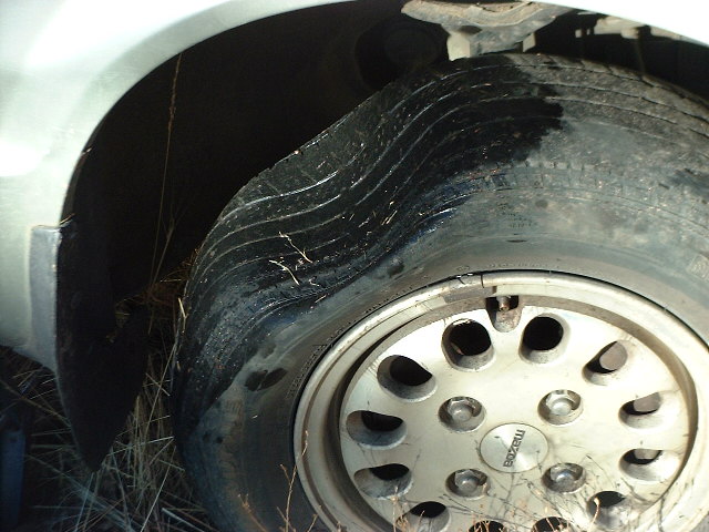
I'm no car repair expert, but I was able to spot this little problem. Trusty tire pump (and jack), to the rescue! This tire was more than shot, anyway - it was in bad shape at the beginning of the trip, and after the Nevada rock incident, there was belting showing through where tread should have been. I nursed it, and another tire that turned out to have a nail in it, back home. Love that pump, and that tire puncture repair kit, they make me feel invincible.
|
|
|
Isn't pretty reason enough for a photo? The country here is half-forested mountains, half-desert, like so much of the West. Cascades "rainforest" meets eastern-Oregon sageforest.
|
|
|
Old abandoned house, ten miles outside Chiloquin. No no trespassing signs, just like there oughtn't be.
|
|
|
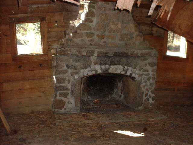
The stories this hearth could tell... Unlike many abandoned buildings in the West, which are usually little more than cabins or barns, this thing was built to last.
|
|
|
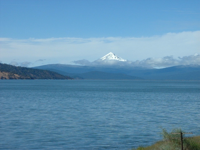
Stand back, she's gonna blow! The view of Mt. McLoughlin (el. 9495'), looking west across Upper Klammath Lake. There was a big to-do a few years back, wherein the farmers' irrigation water allotments were cut due to problems with a local fish in the lake, the Snail Darter (I think). I remember riding through four years previous, and seeing a home-made billboard that said "Without water, no hops. Without hops, no beer." Now that's making it personal...
|
|
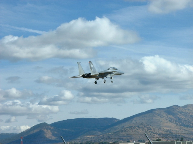
Yet another cool thing about Klamath Falls, a Air National Guard airbase. F-15 pictured coming in for a practice landing, as seen from the road around the end of the runway. Kingsley Field is currently home to an F-15 training wing.
I really liked Klamath Falls, and spent a couple of hours checking out the local stores and library. The town, in my childhood a regular stop on the Greyhound bus route from Oakland to Spokane, just seems a bit untouched by time. Prospering and gentrifying a bit, like nearby Ashland, but still funky and somewhat isolated.
|
|
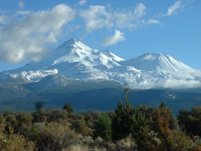
Mt. Shasta has to be seen to be believed. At 14,000', it's almost the tallest mountain in California, but it towers a full 11,000' above the surrounding terrain, which makes it seem bigger than its competitors. The giant, corpulent protrusions attest to the lava trying to get out. In taking this photo, I made a little boo-boo. When another car arrived at the scenic overlook, I hustled to vacate the premises, so that they could enjoy the view like I had. Unfortunately, I left my digital camera on top of the car, and when I got back on the highway, wondered what that silver thing was that was bouncing down the road. Amazingly, after ejecting its batteries, the camera survived, except for an inconvenient problem with the lenscover. But it looked like it had fallen out of a moving car.
After Klamath Falls and the drive down to Shasta, I returned to the (damn) "freeway" and headed home. I had been unable to connect with my friend Kathy in Ashland, and headed for the barn. Car problems (from the Nevada Rock incident) prevented travel above 62MPH, which was a nuisance, but tolerable. (Update: recent developments have brought the max up to 65+MPH, much more tolerable.) Goodbye adventure, hello, home.
|
|
|
Death, the final stage of growth. Ah, what I mean is, here's the final stage in the adventure, creating the website. For this particular adventure, with 100+ photos, and about 65 that made it to the website, plus the attendant long pithy and hopefully insightful captions/text, that's a lot of work. But very satisfying, when finally finished. And to be honest, there was very little "photoshopping" involved, most of the images are shown exactly as they came from my camera. No sharpening, levels adjustment, resizing or cropping, which would have been a good bit of work. Instead, I just threw them at the wall, to see if they'd stick. Which they did.
|
[
travelogue |
contact greg ]
|