AUTUMNAL WEEK IN NORTHERN CALIFORNIA AND OREGON
October 20-27, 2002. Brrr!
|
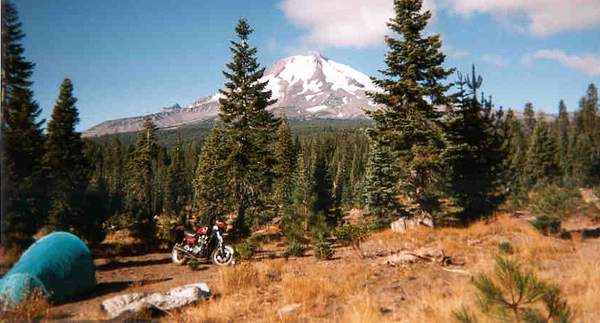
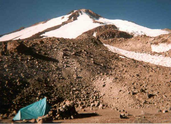
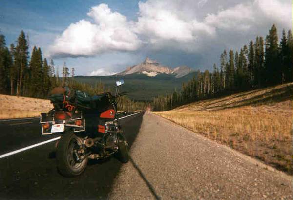
Campsite on the morning of the second day, and the incredible Mt. Shasta from the south-east.
The previous afternoon I'd traversed the northern Central (San Joaquin) Valley, through the towns of Red Bluff and Redding. North of Red Bluff it gets really beautiful. After doing some after-dark dirt roading near Shasta City, I stopped for supplies and gas in McCloud, what a strange little town. I chatted for a while with the manager of the grocery store, Jim, who grew up in McCloud, built Harleys, lived in Yreka, and raised llamas commercially. Then another hour of freezing paved and dirt roads to the campsite pictured.
|
|
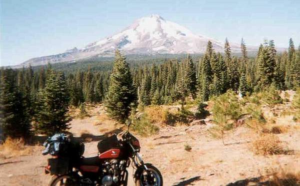
Another view from the same spot, ready to go climb the mountain!
When I saw Mt. Shasta on the morning of the second day, my uncertainty about what was next evaporated. I would climb the mountain. The well-graded Military Pass road took me to the foot of the beast. The dirt roads behind Shasta are generally excellent, though some gravel areas are slow for bikes.
|
|
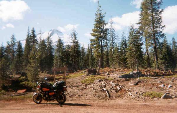
The roads up the mountain are very beautiful, higher in altitude than most forest roads.
It does get a little claustrophobic, in the sense that there aren't many places to pull off and camp, at least as you near the trailhead. Not many years ago, before the top of the mountain was designated a federal wilderness, the roads seem to have gone higher, and been free-er. Near the trailhead, which demands a self-registered parking fee even for day trips, and a larger fee for access above 10,000', pulloffs are almost nonexistent. Nonetheless, it is possible to tuck a bike in out of site. Just remember where you put it, you might save yourself an hour of searching. I think I used the Brewer Creek trailhead east of the peak, there are several trailheads around the mountain.
|
|
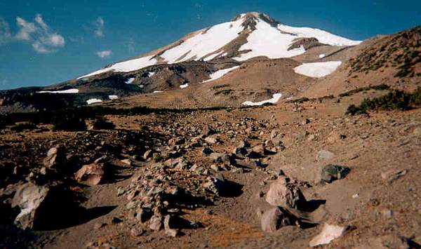
This is what Mt. Shasta looks like at the higher elevations. In October the snow has receded as much as it ever does, and the terrain revealed is a wasteland of brown rocks and brown dirt. The scrub trees at right last until approx. 10,000'.
After stashing the bike, afternoon of day 2, I began a two-night backpacking trip. Half an hour after the trailhead, the landscape quickly turns to rocks, dirt and snow. The trail gets a little tenuous, despite very heavy use in the peak season. (Which late-October weekdays certainly aren't!) Not shown hear is the two grueling hours of after-dark, full-moon ascent, a few steps then a break to breath, then repeat. 10,000' and 20 degrees (before the windchill is factored in), not for the faint of heart.
|
|
I was damn glad to find this flat spot and shelter wall, two hours after dark.
With the full moon the visibility was excellent, but there really had been zero places to put a tent, hardly even a decent place for a camping pad, since dark. But now I was in the last of the pre-glacier terrain, and there were several of these man-made campsites, blessedly cleared of rocks.
|
|
The picture on the left shows the last campsite before the glacier. The photo isn't great, but there are thousands of pounds of rock in that wall. The pic on the right is of a gorgeous little ice crevasse.
|

|
As you can see, the surface of this glacier looks a little like a high-speed photo of moving water. Unfortunately, it was less than soft.
On day 3 I left my stuff at camp and attempted an ascent to the peak. I spent several hours trying to cross and ascend this glacier, without crampons, and was very literally grateful to escape with my life. After having crossed to within 100' feet of the far "shore", the surface of the glacier turned to smooth, clear, rounded ice, with no purchase or foothold, except the rare bit of level smooth ice. A brief attempt at crossing put the fear of God into me. One slip, and it would have been a long way down to the hard and jagged part of the glacier before I could catch myself. Would have been no fun.
|
|
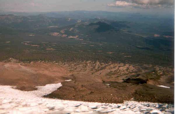
The area behind Shasta is beautiful, and large.
According to the map, the extent of forest land east of the mountain could keep one busy for days, before reaching the eastern Oregon desert. Recommended. And the visible clearcuts indicate that the loggers have been busy, or were at one time. (Down in the valley I saw and heard one small logging operation, didn't seem like much.) A mixed bag, logging -- that's why all the excellent roads are available.
|

|
An ice cave I encountered on the descent, early evening of day 3.
Don't know if this qualifies as glacier, I'm guessing not because it looks like stuff you encounter fairly often in the western mountains. I should mention here that liquid water was not easy to find, existing only during the sunlight hours below some glaciers/snowpacks. Well before dark, the tiny streams froze. And the glacier surface became much more treacherous. I had a surprising moment at about 5:00 in the afternoon of day 3, before breaking camp and two hours before dark, when I noticed my water bottle was freezing. It didn't feel cold, but the thermometer said 26 degrees.
|

|
I spent night 3 back down near treeline, and was sure glad to be there.
Soft sand, scrub pine to break the wind, and nighttime temps in the high 20's were a welcome relief. Day 4 saw me back on the bike, heading for the pavement. I took a wrong turn and departed the Military Pass road, instead heading north-west for a couple of hours of dirt and gravel and pavement before hitting the highway. Surprisingly many roads here were marked as closed, some seasonal and some due (perhaps) to hunting season.
|
|
|
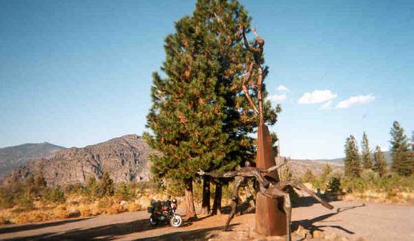
West of Shasta there's a sculpture garden, commemorating the US Army and USMC. This is just one of more than a dozen installations. Definitely worth a visit.
|
|
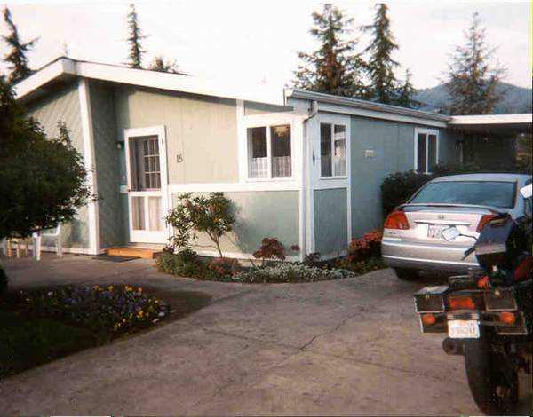
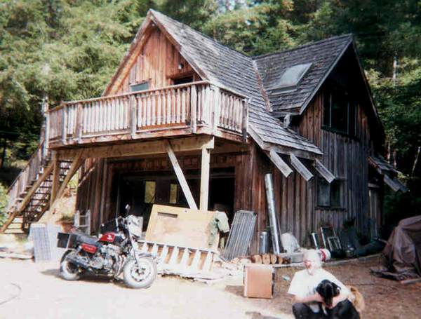
My friend's mom's trailer home in Ashland, Oregon.
Night 4 I spent visiting a friend in Ashland. On the way to Ashland I toured Yreka, seemed blighted. I had the displeasure of watching the local constable issuing tickets to some young kids at the local skate park, probably for lack of helmets. I wonder if logging towns were always so hardscrabble, or is this a consequence of the rundown in logging? But the country is beautiful, and I guess the town was pretty nice. The drive north out of town, along the river, is fantastic.
Ashland is prosperous to the point of yuppydom. A university town, I came to like it. Below the "Irish" pub where we drank the night away, there was a mini-rave dance club that felt like a little piece of Europe or San Francisco. What a surprise. And back at the trailer I had a lovely time with my friend's mom.
|
|
This is Mt. Thielsen, north of Crater Lake. The Cascades are defined by mountains like this, obvious volcanoes stretching from Lassen (and maybe even Diablo) in California to St. Helens and Ranier in Washington (and beyond?).
Leaving Ashland on the morning of day 5, I headed up to the much larger town of Medford and spent a couple of hours exploring. Stopped at a taco truck, the city park (always a great destination when bike touring), and an internet cafe. Then north up Highway 62, through the Rogue River valley, into the mountains. Nights are cold, so I wanted to make camp not long after dark, but my job was complicated by it being the last night of Elk season. Most of the minor dirt roads, my campsite mainstays, were closed, probably to keep the hunters from spending all day "truck hunting". A nice young guy (from Napa, less than an hour from my home) steered me in the right direction.
After spending the night tucked in down a closed road, I woke up to the sound of a helicopter patrolling. Keeping an eye on the hunters, I guess. Never saw it. Had a lovely walk, though.
|
|
|
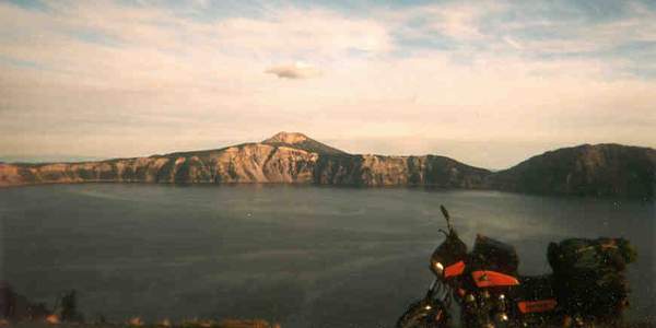
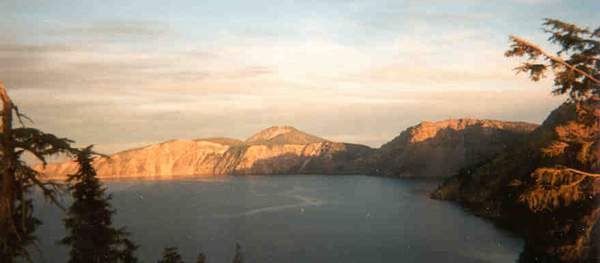
Two views of Crater Lake National Park. Not much of a park, the lake being the entire thing. Pretty amazing to look at, only $5 to get in, and I was almost the only one there. October weekdays rock! And I'll bet the mountain that blew its top to create the lake rocked too.
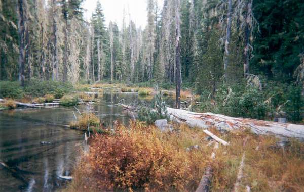
On day 5 I left my campsite and continued north-east on highway 230. Much of this part of the forest is sickly and homogeneous, probably as a result of massive clearcutting. I met a guy named Bret from Hinkley, SoCal. His schtick was that he was sickly, having been poisoned by the local groundwater. Apparently Hinkley was the basis for the movie Erin Brockovich, about a mining town where things went badly. Nice guy, we took a walk and enjoyed the native foliage and forest.
Continuing on to Crater Lake in late afternoon, I came, I saw, and I saw that there was no place to camp. Heading back north, I discovered what it's like to ride a bike after dark in 29-degree weather. In a word, brrr! I stopped at the resort at Diamond Lake, and another nice young hunter (David from Montana) encouraged me to have dinner at the lodge bar, so I did. Not sure the beer helped. Then another 15 miles of frozen ridin' to a cold night sleeping at the end of a dirt road.
|
|
The valley of the Umpqua is classic Oregon river country, almost painfully beautiful. A hint of rain only made it prettier.
Heading west on route 138, day 6, progress was slow at first because the country was so striking. Then the mountains were gone, and the western Oregon lowlands/hill country around me. Grabbing a sandwich in the fairly nice city of Roseburg, I made my way south on I5, taking a detour in search of gas through the once-prosperous little logging village of Glendale. The somewhat toothless attendant at the one-pump filling station had his arm in a sling from a recent bike accident involving gravel. And as I filled the tank, a passing car ran over a beer bottle sitting in the street. People have a view of Oregon as quaint and progressive, but most of the state seems to hover frighteningly close to the poverty line.
After checking out the prosperous tourist town of Grant's Pass, I crossed to the coast via 199 going south-west. Unfortunately it got dark before I made Crescent City, but I had a blast blasting down the roads. Then another 1.5 hours south on 101, through the freezing foggy dark to Arcata.
|
|
My friend's cabin in the woods, east of Arcata.
Arriving at 9:00PM on day 7, we managed to keep the beer and "chocolate blasters" flowing until 2:00AM. No mean feat, after a 12-hour day of riding! The next day, we chilled until the afternoon, at which point it was long past time to start the ride back to the Bay Area, six hours by car and way more the way I bike tour.
|

|
Along the Avenue of the Giants, there are some gravel bars that you can drive down to.
Unfortunately, you may wish you hadn't! Minutes after posing for this photo, and within this frame, I was axle-deep in gravel. Say goodbye to polished rims. I stripped off the backpack and the contents of the boxes, dug myself out enough that the frame and exhaust pipe headers were no longer resting on the gravel, wheels somewhat free, and tried to power my way out. No dice. Turns out the trick is to push it by hand out of the gravel trap, turning the front wheel so that the rear wouldn't have to travel through the rut created by the front, until sitting on top of the gravel bar again. Then carefully dogpaddle back to hard ground, being careful not to get the revs up and the wheels dug in. Then walk back to the photo shoot for all that heavy gear and sweaty clothing.
Then ride for six hours through the freezing night back to Oakland. Hey, sounds easy when I say it like that!
|
[
travelogue |
contact greg ]
|


