
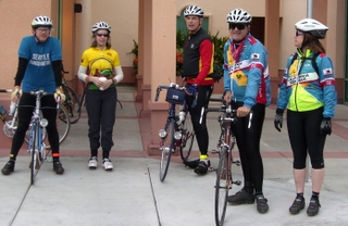
Several members of The Grizzly Peak Cyclists participated in the Santa Cruz Randonneur's 2006 Fleche. There are a number of arcane rules associated with this event, but in a nutshell the defining aspects are: it is a team event, it is meant to be 23-24 hours long, each team designs their own route (all ending in the same place), and routes must be at lest 360 km long. Unless you are riding one yourself, there is no need to sweat the rest of the details. Just trust me, they are, um, bureaucratic. But that is not the point of doing a fleche. This fleche was my second one, the first being in 2004. In both cases, the rides were unlike any other I've done because of the team aspect. They were simply a unique experiences. Team size is limited by the total number of bikes, and we reached that limit with five bikes, with one being a tandem. Bruce Berg and Dan Brekke organized the team and mapped out the route. The rest of the team was made up of Michael Tigges and Susan Jacobson riding a Steve Rex tandem, Veronica Tunucci riding her first overnight brevet, and me, Rob Hawks.
During the early stages of planning for the 2006 Fleche, the original preferred route had us driving a long way to a start point up past the Sierra foothills, but after some thought the emerging route of choice was one that started ten to fifteen miles from where any of the team members lived. From the start location in Hercules we would cross the Carquinez Straits on the Zampa Bridge, over to Vallejo, then up through Fairfield, skirt Vaccaville on the way to Winters where we would stop for lunch, then past the Capay Hills to the west and into Dunnigan, through Arbuckle, and over to Colusa to mark the northernmost point on the route. From Colusa, after a rest stop, we would turn south to the Sutter Buttes, go through Yuba City and Marysville, and across farmland to Lincoln where in the wee hours of the day we would traverse a chain of towns on our way to Sacramento and finally a finish in Davis at 07:00. Not exactly a strict expression of the meaning of Fleche, but there it is.
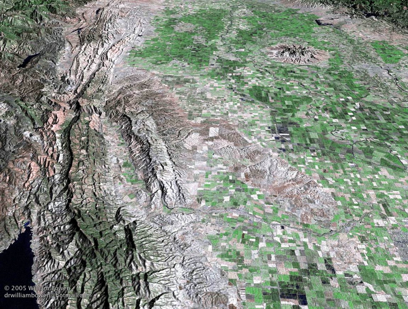
The Aerial photo above shows a portion of the topography of our morning route (entering the photo at center, bottom) and all of our afternoon route up past the Capay Hills to a point northwest of the Sutter Buttes (that object in the upper right that looks like a volcano in disprepair). Our route crossed the Buttes on its southern flanks and then left the area covered by this photo. Use the link in the caption above to go to Geographical Survey web pages which include dozens more aerial photos of California.
The weather forecasts for both the immediate Bay Area, and the portion of the Central Valley where we would later ride were both less than stellar, but of the two the former was slightly better in that the POP (percentage chance of precipitation) was only 50%. As we rolled out of the parking lot we all could feel mist of a very light rain on our faces. The fact of rain early in the ride when there was supposed to be less of a probability for such was a reality we all seemed ready and able to ignore. By the time we had crossed the Zampa Bridge and passed through Vallejo the rain was more than mist, and Bruce and I stopped to add some minimal rain gear to what we wore. While the rain was steady it was not heavy and the trick of staying dry was mostly accomplished by staying out of the rooster tail of spray thrown up by the other riders. Not all of us had fenders and not all of the fendered bikes sported full length fenders. There was less of a need to pace line in these early miles though. We saved that for later in the Central Valley where it would matter more, and with the roads essentially empty of traffic we could ride in groups of two, side by side.
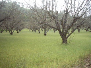
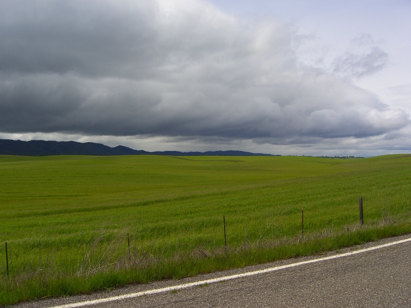
Our first control was a scant 28 miles into the ride and I had had enough of the Burley rain boots I had on and I traded them in right there for the tried and true, though not so durable, plastic newspaper bags, worn this time under my shoes. That plus wool socks and I was happy. After a brief lull in the rain after the control stop, the rain resumed but still didn't amount to much more than drizzle. With the cloud cover as it was, an even light made the green of the fields and hillsides stand out against the wet trunks of trees, or the darkened road surfaces. Somewhere past halfway between our first control and our lunch stop, the rain quit and the roads were dry. It hardly looked as if it had rained there yet. The sky ahead of us seemed to be far less threatening looking than that behind us. After lunch, I knew we would begin the very long and very flat portion of the route that I had some familiarity with.
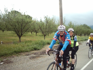
My familiarity, however, was leavened with a dash of contempt. Dan, Bruce and I had done the San Francisco Randonneur's 400km brevet just a few weeks before, and the portion of that ride that overlapped our route on this day was the death march portion of the brevet. On that ride we had fought steady 23 mph direct headwinds (for spice, gusts measured 30+ mph) from 11am until sunset, when we were nearly too spent to enjoy what then became a huge tailwind. Duplicating that portion of the 400km brevet route was still ahead, after lunch, but I think all of us were more immediately enjoying the cessation of the rain and our lunch at the Putah Creek Cafe. While each team member knew the other team members, only Bruce had ridden considerable miles with every other teammate. Lunch was where stories of past rides were told and the stories helped fill in the gaps in the personal histories of each rider. History of course is defined here as only what occured on a bike ride. All this helped me avoid dwelling on what I was expecting to be a painfully dull, and perhaps physically painful section of the right just ahead. 20+ mph headwinds have a way of reducing the physical and visual input one might otherwise obtain on a ride, and all I recall was having my head down as I tried to bull my way into the wind.
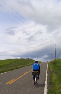 Instead of the realization of my dread though, this trip into the Valley was a revelation. A tailwind will do that. So will gaps in the clouds that reveal that there still is blue sky, somewhere. I wrote that our Fleche route at this point overlapped with that of the SF 400km brevet. To be accurate, our route mimiced but also simplified that route, and of the two I think our Fleche route got it right. After lunch, we headed due north from Winters and skirted the town of Esparto, on our way to Dunnigan. Along this portion, we could see what looked like heavy weather to our west, weather we thought was coming our way. The Capay Hills worked to our advantage though, and what rain there was in the clouds seemed to have gotten squeezed out as the clouds passed the hills. Aside from one very short and very light session of drizzle, our interaction with the rain on this afternoon was mostly visual. Where less than a month ago I saw little more than the road surface and the wheel ahead of me, this time the roadsides were lined with blossoming wildflowers, grasses waving with the (tail)wind, songbirds and wildfowl and ahead rolling clouds, picture rain and gaps with sunshine. Stunning.
Toward the northern arc of our trajectory, we passed through Arbuckle, CA and skirted Williams, CA as we passed to the east. As we approached Colusa, we began to see the floodwaters and signs that the water had been much higher not long before our passing. Since shortly after lunch, we'd been getting glimpses of the Sutter Buttes, and now we were a bit northwest of them. Our route would take us right through the Buttes, which would be the payoff for having watched them bobbing on the horizon for hours. Due to the flooding though we had to take a much longer route than planned. Pass Road which crosses the Sacramento River was completely underwater. The extra leg south and then north gave us one more run with a tailwind and once we entered the Buttes themselves, the wind was much less of a factor until the next morning. The topography of this section of our route was dominated by the river, the levees bordering the river, and the flat, flat farm land all around. That water was to be a prominent feature was clear as we left Colusa itself and climbed up on the levee road. Any wide spot in the road was cluttered by farm equipment, trailers, cars and anything else mobile enough to be moved to higher, drier ground.
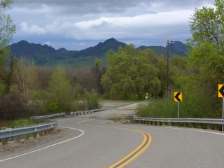 It is very easy for me to name the highlight of the trip and that was the road through the Buttes. Even though we had consitently been ahead of our schedule, Bruce urged us on so that we would cross the Buttes in daylight and our push paid off big time. Sunlight managed to escape the clouds to the west and the light on the hillsides was dreamlike. The landscape is really wonderful there and in the middle section the ground looks like it has been undisturbed for eons. I can't fully blame someone for wanting to live there, but it was with regret that I noticed all the new homes built or being constructed there right now.
Rolling out of the Sutter Buttes would be our last real taste of any hill climbing for the rest of the ride. Our next stop would be a dinner stop. There are reasons why a team looks to it's captain, and displays of sound judgement and genius level thinking are excellent qualities, ones you want in a Fleche team captian. Bruce, wise man that he is selected a Taqueria as our dinner stop. I don't think anything more needs to be said. The daylight had nearly faded completely when we pulled into the dinner stop, and as we left it was completely gone. The temperatures had dropped in a noticable way, but not so much that after a mile or two of pedalling each of us were warm and comfortable.
Yuba City and Marysville were at a disadvantage in showing their charms, being only lit by streetlights, so we made what haste we could in passing through. Lincoln would be our next town and rest stop and in between were miles of dark and flat roads. With the reduction in visual input, often the mind begins to focus on other things. For the others, conversations continued, but for me I was thinking too much about the pain in my left knee. That pain had settled in for certain as we approached Colusa, and no amount of stretching seemed to mitigate the issue. I was having trouble holding on to the back of the group as we rolled down Highway 65. Traffic was a lot higher on this road, but at that time of night not a problem at all. Higher traffic in this case meant a car or truck every five minutes, as opposed to no traffic at all on the rural side roads. I was under orders to report back to my son on all the various birds I might spot on the ride, and even though it was now dark and had been for many hours, I was able to add to the list when I spotted an owl hunting in the fields to our right as we neared Lincoln.
Lincoln was the beginning of a long stretch of suburban and urban roads on our route. While Lincoln was a town in transition, not all of the planned transition has happened yet. At this point, there are yet to be any hotels or even motels. If there had been any, I am pretty certain that I would have quit at this point and checked in for the night. This was my third major ride that would go through the night and past dawn. By this time I had learned enough to know what was ahead in the figurative sense. Because of the tailwinds through the afternoon and the very congenial pace since nightfall, I really wasn't tired. It was entirely the pain in my knee. We had the good fortune to have four very seasoned long distance riders on the team and for good measure, one of them was a doctor. After some debate it was decided that we would go to the all-night Safeway grocery store for our break, and the break would be a little longer than planned. We still had time in the bank so to speak so a little more time spent here wouldn't put us in the red. Susan and Bruce convinced me that the two ibuprofen tablets I had take six hours before were inadequate for the job. With a bag of frozen peas on my knee and a proper dose of NSAIDs in my system the rest on the couch near the Starbucks counter in the store was the right thing to do. It took about seven miles or so after we left the Safeway for the anti-inflamatories to take full effect and with the team pace racheted back one more notch, what had looked like a miserable night turned back into something more like fun.
By the time we reached Roseville, I knew I could finish the ride. We had a control stop in town and we were now into the portion of the route where the segments were short and the stops more frequent. I was after calories and treated myself to a slice of chocolate cake. It was amazing how bustling the Dennys was at nearly 2 am. While we weren't dressed like any of the other patrons, we weren't made to feel out of place. The night manager was impressed with our ride, and one young woman from a nearby table came by to ask about the ride. Riding out from this stop, Veronica, Michael, Susan and I were indebted to Dan and Bruce for leading our way. Out in the fields and hills near Dunnigan, there aren't many roads to choose from and there is little to block your way when looking around. In the night, on the roads between Roseville and Sacramento, one road looks like the next and there are dozens and dozens of them. Dan knew the way in particular through Fair Oaks, and that came in handy when we realized we forgot to get the receipt for our brevet cards. Without that proof, credit for the whole ride might have been denied for the whole team. We made our way to the only business open that we could find and got a reciept there. This was just on the outskirts of the village center for Fair Oaks. At first I imagined that what I heard was a sound made by some wag on his way home from a late night at the bars. Then I heard the crowing from the other side of the street. As we rode through the village the source of the noises became clear. Free range roosters and chickens were running around in the town park, perched on the railings of balconies, and rooting around in the yards of houses. While we certainly weren't traveling silently, it was only the roosters themselves that seemed to notice.
One last stop was planned for the Lyon's Restaurant in downtown Sacto. In contrast to the Denny's in Roseville, there were very few diners here. In spite of that our food was a long time in coming, and this put us behind our schedule. We had to hurry through Sacramento and toward the Yolo Causeway. No amount of hurrying was going to help us beat the rain though, and before we left West Sacramento, the skies opened up and pelted us with rain. In an odd way, that was helpful as the rain drowned out, if you'll excuse the phrase, the highway noise. The last run into Davis was straight as an arrow. The team members got a little strung out on the bike path portion but once we hit the city proper we gathered once more into a pack and made our way in the rain to the bagel shop where Bill and Lois were waiting to check us in. We made it with 9 minutes left of our 24 hours.
In spite of the knee pain I had, I can't think that this was anything but one of the best rides I've ever done. A great group of teammates riding on an excellently prepared route, with just enough bad weather to allow us to brag. At ride's end, we all bought tickets on the Amtrak for the trip back to Berkeley after collecting a dry change of clothes that we stored at Bruce's Davis office.
Veronica had ridden from Berkeley and picked me up in Richmond and we both rode over to the ride start in Hercules. For her, the ride total was 260 miles, and for me 256. The rest had about 246 miles for the Fleche route itself. Amazingly, we had no flat tires and the only mechanical issue was Bruce's saddle adjustment.
Santa Cruz Randonneurs Fleche results and ride reports.
(May Knee update: The problem was ITB friction syndrome for which I've seen a doctor and a PT. The PT assessment is that I have extremely tight Ilio-tibial Bands and I need to do a lot of stretching to keep this under control. The tippping point for the onset of this was likely extremely worn cleats on my commute shoes which put my feet in a position that would amplify the friction on the ITB during the pedal stroke. I've also gotten new shoes with the new cleats for further stability and support. So far, things have improved a great deal.
August Knee update: I had trouble again on the Davis Double in later May, and as a result I had to drop out of the Santa Rosa 600 and the Cascade 1200. As of late August, I'm back to riding centuries and while I have some stiffness sometimes, mostly I'm managing the ITBS fairly well. I plan on riding the Knoxville Double Century in September.
October Knee update: The Knoxville Fall Classic Double Century went
wondefully for me. No ITB issues during and after the ride. The week after the ride my legs and especially my left ITB felt better than they have all year. I owe this no doubt to daily stretching sessions, plus unworn cleats and using orthotics in my riding shoes.