|
Fort Point San Francisco January 28th, 2017
content updated Sep 15, 2015 return to 20th Maine homepage return to Calendar of Events |
|
|||||||||||||
|
NOTE: the fort is open rain or shine, but the event is subject to cancellation or rescheduling (with or without much notice) if the national threat level is elevated.
This page contains the following information: o Contact Info and Links to National Parks Official Fort Point Website o History of Fort Point and other Research o Public Information o Reenactor Information (located on a separate webpage) o Schedule of Activities at the Fort o Directions to Fort Point and Presidio Map o Hotels near Fort Point
NOTE: this page works best in MS Internet Explorer.
Public Information
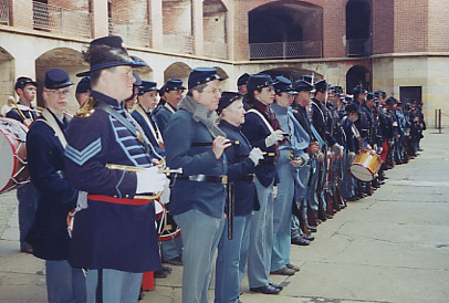
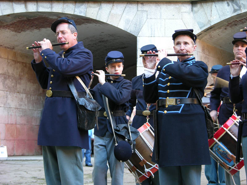
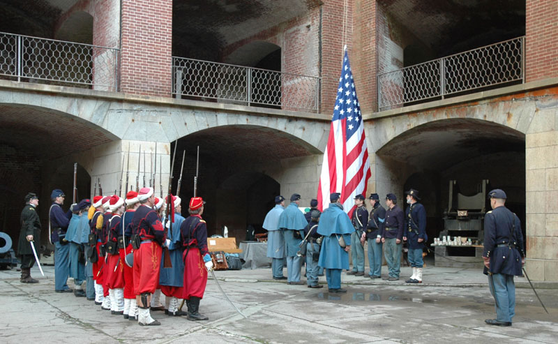
The fort is open to the visiting public from 10am until 5pm Friday through Sunday. This is your chance to see members of local reenactment groups and Civil War organizations perform living history demonstrations as well as talk about their organizations and research. We will have infantry and artillery drills as well as civilian, musician and medical demonstrations.
Please help us to spread the word about the event with these tools (email Mike for latest versions)!
Contact Information
For information about the Fort, please feel free to call the rangers at (415) 556-1693. For information about reenactors and the living history event, Contact Mike Musante (mikemusante @ hotmail.com or 510-551-5128).
Fort Point General Info: http://www.nps.gov/fopo/index.htm
This website is designed to provide information for reenactors (as well as public) regarding the upcoming Fort Point event.
History of Fort Point
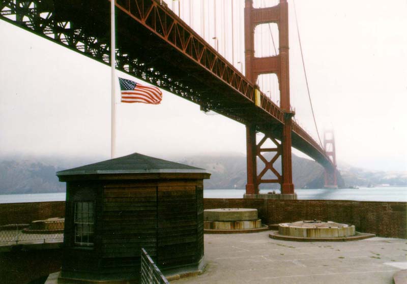
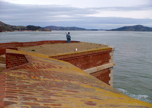
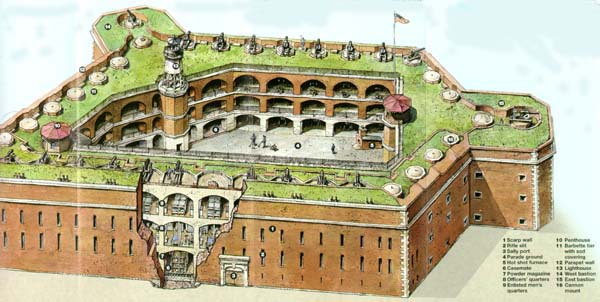
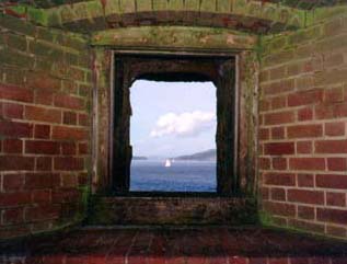
Fort Point was constructed by the U.S. Army Corps of Engineers between 1853 and 1861 to prevent entrance of a hostile fleet into San Francisco Bay.
The fort was designed to mount 126 massive cannon. Rushed to completion at the beginning of the Civil War, Fort Point was first garrisoned in February of 1861 by Company I, 3rd U.S. Artillery Regiment. The fort was occupied throughout the Civil War, but the advent of faster, more powerful rifled cannon made brick forts such as Fort Point obsolete. In 1886 the troops were withdrawn, and the last cannon were removed about 1900. The fort was then used for storage and training purposes for many years.
Between 1933 and 1937 the fort was used as a base of operations for the construction of the Golden Gate Bridge. During World War II, Fort Point was occupied by about 100 soldiers who manned searchlights and rapid-fire cannon mounted atop the fort as part of the protection of a submarine net strung across the entrance to the Bay.
Fort Point is the only third system brick fort on the West Coast of the United States. It became a National Historic Site on October 16th, 1970.
The table below includes some additional resources and research about Fort Point.
Other links about Fort Point and the history of San Francisco: Fort Point Exhibits: http://www.nps.gov/fopo/exhibits.htm Fort Point 1848-1876: http://www.nps.gov/prsf/coast_defense/third_system/fort_point/ftpoint.htm San Francisco Virtual Museum: http://www.sfmuseum.org/hist5/civwar.html Scenes of Wonder and Curiosity in California by James M. Hutchings (1862): http://www.yosemite.ca.us/library/scenes_of_wonder_and_curiosity/san_francisco.html Civil War Fortifications: http://civilwarfortifications.com
Schedule of Activities note: schedule is subject to change
Infantry drills occur almost every hour on the hour. Artillery discusions occur every hour on the half hour. There are also concurrent demonstrations throughout the day - medical demos, musician (fife / drum and brass band), and civilians (camp laundress, sewing, etc).
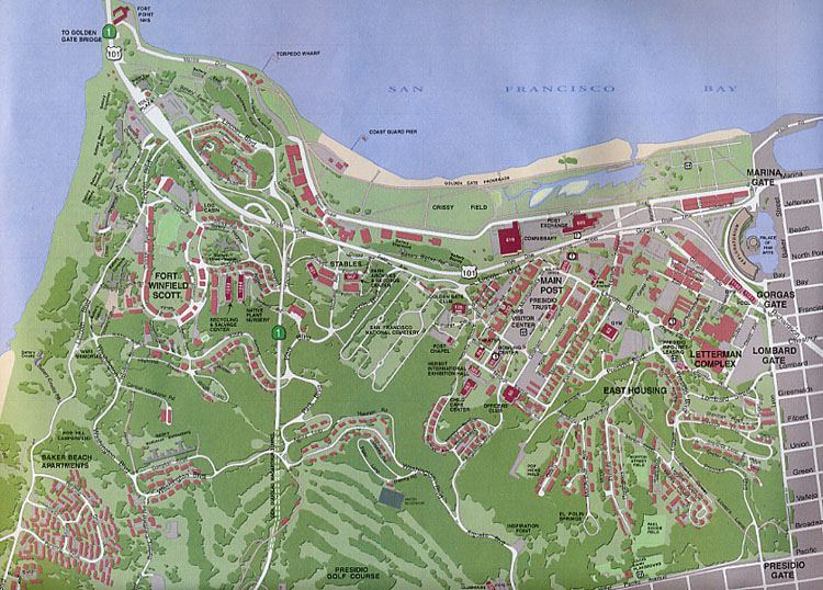
Maps and Directions to Fort Point
Fort Point is located next to the southern anchorage of the Golden Gate Bridge. Click on the thumbnail or HERE for a map (173kb in size) of the SF Presidio courtesy of the Park Rangers. A better PDF version of the map (2.7 MB in size) that allows you to zoom in for greater detail can be found at this link (http://www.nps.gov/goga/maps/pdf/map-prsf.pdf). There is also a map of where the 2 parking lots are located HERE.
Parking can be very challenging as there are limited spots in front of the fort. We suggest trying to park at the Crissy Field lot near the Warming Hut (enter on Mason Street side), or the gravel lot overlooking the fort (Battery East). Both involve a bit of a walk to the Fort. Another option is to park up in the Presidio and take the Presido Go busline. You will need to check with them regarding bus schedules to and from the fort.
Here are directions heading to the Fort from various areas:
FROM THE NORTH: Proceed over the Golden Gate Bridge, staying in the farthest right lane. After passing through the toll gate, take the first available exit to the right, continuing in a circle to the right, through an underpass, through the visitor parking lot, to a stop sign (Lincoln Blvd.), then turn left onto Lincoln Blvd. Follow road for about 1/8 mile and turn left onto Long Avenue/Marine Drive and go down the hill to the fort. At the base of the hill to your right is the additional parking lot for reenactors next to the Warming Hut (white buildings), just northwest of Crissy Field.
FROM THE SOUTH: As you approach the Golden Gate Bridge, stay in the farthest right lane and take the "Last San Francisco Exit". Proceed through the parking lot to your right until you reach the stop sign (Lincoln Blvd.). Turn left and proceed to Long Avenue/Marine Drive and go down the hill to the fort. At the base of the hill to your right is the additional parking lot for reenactors next to the Warming Hut (white buildings), just northwest of Crissy Field.
FROM THE EAST: It is best to get a map because you will have to drive in downtown SF. This is probably the easiest way: take the first San Francisco exit after crossing the Bay bridge and get on the Embarcadero heading northwest. Since the Harrison St. off ramp has been closed since Fall 2005, you will need to stay in your 2 right lanes on the Bay Bridge and exit on Fremont Street. At the end of the long offramp, make a left on Fremont, and your first right on Howard. Then make a left on the Embarcadero. Follow the Embarcadero until you reach Bay street and make a left onto Bay (at pier 33). Follow Bay for 10 blocks and make a left on Van Ness. In 3 blocks you will make a right on Lombard. Drive west on Lombard Street and instead of taking Richardson Avenue to the Golden Gate bridge, make a left to continue on Lombard through the east gate of the Presidio. At the first intersection in the Presidio, make a right on Presidio drive, which becomes Lincoln Blvd. At the main post there is a fork in the road, make a right and follow signs to Fort Point. At the cemetery, you will make a slight right turn on Sheridan, which will again merge with Lincoln. Lincoln will take you on a windy path through the Presidio. Make a right on Long Avenue, go down the hill to Fort Point. At the base of the hill to your right is the additional parking lot for reenactors next to the Warming Hut (white buildings), just northwest of Crissy Field. NOTE: as of Jan 2010, the Doyle Drive construction project may cause delays or detours.
FROM THE WEST: Get a boat...
Hotels near Fort Point
Economy Inn 1 Richardson Avenue at Lombard San Francisco, CA 94123 (415)
922-0810 Travelodge Presidio 2755 Lombard Street San Francisco, CA 94123 (415) 931-8581 reservations (800) 578-7878
2707 Lombard Street San Francisco, CA 94123 (415) 567-2425
La Scala Inn 2555 Lombard Street San Francisco, CA 94123 (415) 921-3105
Econo Lodge 2505 Lombard Street (at Divisadero) San Francisco, CA 94123 (415) 921-2505
Marina Motel 2576 Lombard Street (at Divisadero) San Francisco, CA 94123 (415) 921-9406
Pacific Motor Inn 2599 Lombard Street San Francisco, CA 94123 (415) 346-4664 (800) 536-8446
Travelodge on the corner of Columbus and Bay 1201 Columbus Avenue San Francisco, CA 94133 (415) 776-7070
Local SF History (under construction) - barbary coast pirates - emperor norton - sydney albert johnston
Emperor Norton source: SF Chronicle Magazine, Jan 5, 2003, page 8, article by Tim Goodman
Joshua A. Norton was a successful business man before a failed rice market deal in 1854, personifies local lunacy. Five years after going bust, he went, well, off. He proclaimed himself Norton I, emperor of the United States and protector of Mexico. And he was serious.
It was a slow news day. The good people of San Francisco ate it up.
A legend grew around him, fueled by newspaper coverage. Archives suggest that businesses accepted his handmade money. Copys saluted him. He made decrees all the time, such as this one July 16, 1860: "Dissolved the United States of America".
Emperor Norton died January 8, 1880. Some 10,000 people turned out for his funeral.
return to 20th Maine homepage return to Calendar of Events
|
||||||||||||||